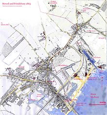
Frindsbury
Through the centre of this ran a shallow valley carrying a stream draining the Hoo Peninsula behind, through Islingham to Whitewall creek where it entered the Medway.
There is evidence of Roman piling so they could build a road, Watling Street, from Strood Hill across the marsh to the Medway which they bridged.
There was a chapel of ease at Strood (St Nicholas'), where Watling Street left the firm ground to run over the marshes to the Medway bridge.
The artefacts were recovered from fluvial deposits in the Medway Valley and are thought to date from the Marine Isotope Stage 9 interglacial.
The larger flint handaxe at 29.6 cm long makes it the third largest known to be found in Britain.
Michael Nightingale in 1953 argued that there was a Roman Villa at Frindsbury to produce food to supply the garrison at Durobrivæ, modern Rochester, Kent.
Following the Danish wars or the 9th and 10th century the area was wrested from the church and eventually came under the control of Harold Godwinson.
Archbishop Lanfranc recovered them again at the Trial of Penenden Heath (c.1072) and restored them to Bishop Gundulf of Rochester.
[11] Gundulf was responsible for commencing the rebuilding of Rochester Cathedral and establishing the Benedictine Priory of St Andrew based upon it.
He gave the land at Fridsbury to the new priory though insisting they paid an 'exenium' to him or his successors on St Andrew's Day.
[c] Bishop Gilbert de Glanvill claimed Frinsdsbury back from the monks "as belonging to the maintenance of his table" in 1185.
[11] According to Hasted the bishop succeeded in obtaining the church, but the manor remained in the possession of the monks until the dissolution of the monasteries under Henry VIII in 1523.
However, the church sided with the monks, and on Whit Monday the Frindsbury lads had to do penance by walking to abbey and craving forgiveness carrying their clubs.
Modern day Frindsbury is often referred to as North Strood as it lies within the borders of the very northern part of the town, contiguous to the village of Wainscott.
The parish includes Upnor, Wainscott, Chattenden and various other small hamlets which are situated north of the main town Strood.
The barn is owned by the Church Commissioners who, prior to the fire, leased it to the farmer as an equipment store.
[21] The heart of the structure is a series of rectangular frames (arcade posts and collar beams) rising approximately 5 metres (16 ft) above the dwarf walls.
[22] Although the structure shows little sign of decay and replacement, the rafters above the aisles of bays 7 and 11 are of machine-sawn softwood.
Evidence of this activity is present in chisel work, nail holes, mortices and the impression of boards in remaining timbers.
In bays 8 and 9 worn cobbles and granite setts are again associated with animals, particularly with a nearby stable door and chewed timbers.
[29] The purpose of a mediaeval church was to raise revenue for the Bishop (the same man being the Rector of Frindsbury), and the lands needed to be managed.
The Bishop knowing the income would appoint a clerk in Holy Orders say mass and minister to the congregation- he would become the vicar.
Wealth and poverty was thus dependent on the generosity of a handful of employers and the state of the national economy, boom and recession.
As one industry abandoned the land it had despoiled, newer ones moved in and used the space, and finally this was turned over to housing.
The brick were graded as Firsts, Seconds (used for facings), Thirds (used for internals), Roughs (used for hardcore) and Chuffs that were unusable.
[36] Subsequently, six more cement works were built along Limehouse Reach, all using the chalk that forms the Frindsbury ridge, and alluvial clay from the Medway Estuary.
The works had limited raw materials, and its capacity was reduced to around half its peak size, before finally shutting down in 1963, after most of the chalk on the Frindsbury peninsula had been used up.
To get under the Rochester Bridge, without losing headway, barges would approach at speed and drop their mast, using the winch at the bow, and when safely under, raise it again.
Ebenezer Forest wrote a journal of the five-day trip containing the lines "we all proceeded merrily to Frendsbury".
[3] [47] In 1783, engravers Samuel and Nathaniel Buck drew their prospect of Rochester from the top of All Saints' Church Tower.