GIS and environmental governance
Social and technological evolutions have elevated digital and environmental agendas to the forefront of public policy, the global media and the private sector.
Government departments routinely use digital spatial platforms to plan and model proposed changes to road networks, building design, greenbelt land, utility provision, crime prevention, energy production, waste management and security.
Non-profit organizations also incorporate geospatial and web-mapping approaches into political campaigns to lobby governments, to protest against socially or environmentally harmful companies, and to generate public support.
Private business, whether in land management, resource extraction, retail, manufacturing or social media for example, also incorporate GIS into overall profit-making strategies.
[3] Although more narrowly used to describe the shift to specifically user-generated forms of knowledge creation, it has been routinely invoked in both the public participatory GIS and environmental governance literature at large.
Each year over the winter period, the American conservation organization encourages volunteer bird-watchers to gather information on the number of bird species in their local area.
The eBird project – enabling the general public to explore a range of map- and chart-based bird species datasets – is a result of these yearly mass volunteer events.
The National Audubon Society has been deeply involved in the Gulf Oil Response since the disaster, and has a dedicated program to co-ordinate resources, liaise with local government, and deploy equipment post-spill.
Not only was the National Audubon Society's citizen science initiative highlighted as the "backbone ... for understanding the [immediate] impact of the disaster",[5] but also for long-term efforts to monitor the health of imperilled species in the Gulf Coast region.
Moreover, their grassroots ethos has mobilized a vast number of Gulf volunteers to "urge elected officials and government agencies to hold polluters like BP accountable",[5] for the financial, environmental, economic and social costs associated with such disasters.
The notion of volunteered, user-generated, citizen data is the guiding mantra for such projects, and the cornerstone of any wider attempts to lobby national governments, engage with local community groups, and generate scientific research.
Royal Docks' residents are continually plagued by planes taking-off and landing at London City Airport, and plans to expand the number of flights a year by 50% (up to 120,000) were opposed by local communities on the basis that it would decrease their quality of life.
Web-based mapping platforms serve as useful tools for national conservation societies, local community groups and planning departments to compile tangible data on environmental issues.
Nuclear power stations, wind farms, landfill sites, and other energy facilities are often subject to NIMBY opposition for aesthetic, health and social reasons.
A lack of recognition in local community discourses, "demonstrated by various forms of insults, degradation, and devaluation",[7] marginalize those already least able to contest political decisions.
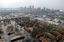
By using a Cadastral-based Expert Dasymetric System (CEDS) they were able to estimate the number of "vulnerable sub-populations" in the densely populated New York City area.
Maantay and Maroko use Federal Emergency Management Agency (FEMA) floodplain and tax-level datasets to determine the potential number of people at risk.
[7] As noted by themselves; "the disadvantages suffered by racial and ethnic minority communities during and after disasters are due primarily to their low economic status and lack of political power".
Planned cities - designed entirely from scratch - routinely use digital technologies to visualize and demonstrate urban layouts, building structures and transport arrangements.
Although CAD/CAM technologies are often used to assist in the visualization, construction, and delivery of certain engineering features, GIS helps to realize distinctly spatial components of the city.
A dedicated GIS team is responsible for "managing the overall spatial information needs" of the project,[13] starting with the drawing of a common base map with which to support the city's infrastructure.
By drawing spatial buffer zones around potential PRTS stops, passenger-distance maps can visualize residential areas that fall outside of ideal service requirements.
A smooth, functioning PRTS is a central infrastructural aspect of Masdar's grand vision, and engineering companies who specialize in GIS technologies have helped in realizing this digitally-orchestrated dream.
Originally coined by Slavoj Zizek, and discussed by the likes of Jacques Rancière and Erik Swyngedouw, the post-political critique argues that life in the Western world is routinely characterized by the de-politicizing effects of a "consensual police order".
[16] A number of different techno-managerial "fixes" have been sought by neoliberal governments in order to solve expressly environmental problems, rather than due political processes.
As Swyngedouw has argued, such forces have "replaced debate, disagreement and dissensus with a series of technologies of governing that fuse around consensus, agreement, accountancy merits and technocratic environmental management".
[16] The apparatus of choice for the techno-enviro-managerialist, if Ranciere and Swyngedouw's analyses are to be put forward, and Elwood, Crampton and Leszczynski's criticisms are to be accepted, is GIS.