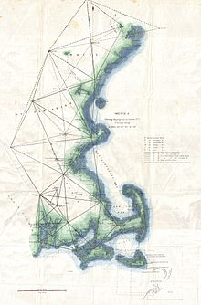
Geodetic control network
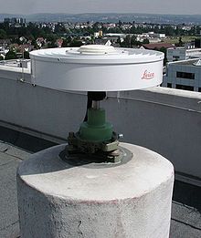
The principal instruments used are theodolites and tacheometers, which nowadays are equipped with infrared distance measuring, data bases, communication systems and partly by satellite links.
EDM increased network accuracies up to 1:1 million (1 cm per 10 km; today at least 10 times better), and made surveying less costly.
Another important improvement was the introduction of radio and electronic satellites like Geos A and B (1965–70), of the Transit system (Doppler effect) 1967-1990 — which was the predecessor of GPS - and of laser techniques like LAGEOS (USA, Italy) or Starlette (France).
While these developments have made satellite-based geodetic network surveying more flexible and cost effective than its terrestrial equivalent for areas free of tree canopy or urban canyons, the continued existence of fixed point networks is still needed for administrative and legal purposes on local and regional scales.
Global geodetic networks cannot be defined to be fixed, since geodynamics are continuously changing the position of all continents by 2 to 20 cm per year.