Geography of Tennessee
The U.S. state of Tennessee is geographically diverse, with varying terrains and several distinct physiographic regions.
Its landforms range from the Blue Ridge Mountains in the eastern part of the state to flat and fertile plains along the Mississippi River.
[3] Once at the Tennessee River in the western part of the state, the border shifts south onto the actual 36°30′ parallel.
[7][8] Minor regions include the southern tip of the Cumberland Mountains, the Western Tennessee Valley, and the Mississippi Alluvial Plain.
[9] Kuwohi is the highest point on the Appalachian Trail and the third-highest peak in the United States east of the Mississippi River.
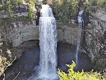
This area of Tennessee consists of numerous linear parallel ridges and valleys that trend northeast to southwest, the general direction of the entire Appalachian range.
[citation needed] West of the Cumberland Plateau is the Highland Rim, an elevated plain that surrounds the Nashville Basin.
Much of the Nashville basin is relatively level, and supports rich, fertile farmland and a great diversity of natural wildlife.
[19][20] It averages about 600 feet (180 m) above sea level, although elevations vary greatly, with some hills reaching higher than the Eastern Highland Rim.
Porous limestone bedrock underlies the Nashville Basin and much of the Eastern Highland Rim very close to the surface.
[17] Nashville is in the northwestern corner of the Basin, and most of its suburbs radiate outward to the south, southeast, and east, owing to its geography.
[23] The flat western part of the plain contains extremely fertile soils, and is one of the most productive cotton producing regions in the country.
[24] This flat strip, commonly known as the Mississippi Bottoms, ranges from 10 to 14 miles (16 to 23 km) wide, and has an elevation of less than 300 feet (91 m).
All of West Tennessee is part of the Jackson Purchase historical region, and it is the least populated of the state's Grand Divisions.
[citation needed] Geological formations in Tennessee largely correspond with the state's topographic features, and, in general, decrease in age from east to west.
Most of the Blue Ridge Mountains in the east were formed during the Precambrian era, and contain the state's oldest rocks, igneous strata that is more than 1 billion years old.
[26][27] Most of the southern Blue Ridge Mountains are composed of Precambrian granite and sedimentary rocks, and Cambrian strata that have been altered by metamorphism.
Shale and carbonate rocks that formed during the Ordovician period are found in the Nashville Basin, Ridge-and-Valley region, and the Sequatchie Valley.
[28] The inner part of the Nashville Basin is a geological dome that was uplifted between 300 and 400 million years ago during the Carboniferous and Devonian periods.
[31] The Cumberland Plateau was formed during the Pennsylvanian period about 300 million years ago, and consists predominantly of sandstone, silt, and shale, with an abundance of coal.
The region is considered one of the most seismically active zones in the Southeastern United States, and frequently produces low-magnitude earthquakes.
This seismic zone produced a series of devastating earthquakes between December 1811 and February 1812 that formed Reelfoot Lake near Tiptonville.
[38] The Cumberland River flows through the north-central part of the state, emerging in the northeastern Highland Rim, passing through Nashville and the northern part of the Nashville Basin before turning northwest to Clarksville and entering Kentucky west of the Tennessee River.
[39] A small part of north-central Tennessee in Sumner, Macon, and Clay Counties is in the Green River watershed.
[52] Middle Tennessee is home to many unusual and rare ecosystems known as cedar glades, which occur in areas with shallow limestone bedrock that is largely barren of overlying soil and contain many endemic plant species.
[53] Common mammals found throughout Tennessee include white-tailed deer, red and gray foxes, coyotes, raccoons, opossums, wild turkeys, rabbits, and squirrels.
[56] The Gulf of Mexico is the dominant factor in the climate of Tennessee, with winds from the south being responsible for most of the state's annual precipitation.
[60] The state averages about fifty days of thunderstorms per year, some of which can be severe with large hail and damaging winds.