Geological Survey of Pakistan
[5] In the 1970s, due to its expansion and scientific capabilities, the GSP was instrumental in carrying out work on nuclear geography, when its scientists frequently visited in various mountain ranges of the country.
[9] The GSP notably carried out an ingenious work on nuclear geology and geography as part of the clandestine atomic bomb project, and played an integral role in the selection of the test sites.
[13] In the 1990s, the GSP also discovered the large deposits of Gold and Copper in Western Balochistan, southwest Pakistan.
In the 2000s, the GSP gained international and public prominence when its scientists discovered and unearthed the first ever dinosaur fossils in Pakistan.
[14] The remains were thought to be around ~70 million years old and were found by geologists mapping the Barkhan district of the country's arid Balochistan province.
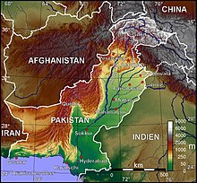
[18] Regional Offices of GSP In 2006, the Geological Survey's two scientists published an assessed report, predicting the hydrological threat posed to the country.
[19] The survey was conducted immediately after the devastated earthquake in 2005, and the GSP's scientists began to study the hazards in the region, which were still geologically unstable.
[19] In 2009, the GSP submitted another report that recommended the potentially hazardous areas of Northern Pakistan where the earthquake and seismic activities were suspected.