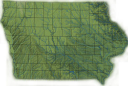
Geography of Iowa
[1] Seventy-four million years ago, a large asteroid crashed into what is now southeast Pocahontas county creating the Manson crater.
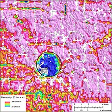
[3] A much older meteorite strike created the Decorah crater during the Middle Ordovician Period, 470 million years ago.
The impact, equivalent to 1,000 megatons of TNT,[5] did not appear to penetrate the Earth's mantle, but it did push down the underlying Ordovician and Cambrian bedrock several hundred feet.
Sioux quartzite is a very hard rock of ruddy pink color used extensively in the region for road and railroad beds.
They consist of grey to pink cobbles within limestone that when cut or smashed open reveal a hollow crystal-filled interior.
Prior[19] divides Iowa into eight landforms based on glaciation, soils, topography, and river drainage: Also known as the Driftless Area, this region of scenic, high relief landscapes includes such features as resistant, bluff-forming bedrock outcrops, deep V-shaped valleys, caves, springs, and sinkholes.
The classic Iowa landscape, consisting of rolling hills of Wisconsin-age loess on Illinoian (or earlier) till.
Generally level areas of stream terraces, paleochannels, backwater sloughs, and oxbow lakes are found within the broad Mississippi River valley.
Highly eroded, leaving stark, beautiful "golden hills".Northeast Iowa is covered with eroded Pre-Illinoian till with moderate loess formation, frequently in the form of paha ridges, muted relief except for steep rolling hills near river valleys, and deeper valleys.
Like the Iowan Surface, the Northwest Iowa Plains are rolling hills consisting of eroded soils developed since pre-Wisconsinan glaciation, but with significant amounts of loess.
In Iowa, the eastern border of the Missouri Plains is the Loess Hills, forming steep rounded bluffs.
[40] Some communities, such as Iowa City resort to additional carbon filtration and lime softening coagulation-sedimentation to make the water more palatable.
In addition to pollution threats, the aquifer is threatened by overuse in well-source irrigation, ethanol production, and the diminishment of resupply caused by extensive field tilling.
The aquifer has dropped by as much as 300 feet since the 19th century, resulting in dry wells, the disappearance of natural surface springs, and the diminishment of water quality.
[45] Like most Upper Midwest and Plains states, radon is a common problem in Iowa, especially in areas with clay-rich soils.
Floods in 1993 washed away all the soil and unconsolidated bedrock along the spillway of the Coralville Lake Dam in Johnson County, exposing a rich collection of Devonian-age fossils.
The deep loess that covers much of western Iowa typically conceals the bedrock, limiting opportunities to finding dinosaurs to mining and quarrying operations.
[49] Archaeological and paleontological sites in Iowa have produced an extensive collection of Pleistocene and Holocene animals; these have been used to reconstruct past environmental conditions in the Midwest.