Gibson County, Indiana
[2] In 1787, the fledgling United States defined the Northwest Territory, which included the area of present-day Indiana.
Starting in 1794, Native American titles to Indiana lands were extinguished by usurpation, purchase, or war and treaty.
The United States acquired land from the Native Americans in the 1804 Treaty of Vincennes, which included the future Gibson County.
Settlers had been pouring into the extreme southwest part of the Indiana Territory starting in 1789, and by 1813 there was sufficient to form a local governing body.
On April 1, 1813, the Territorial legislature authorized partitioning a further large section of Knox to create Gibson County.
The first white settler of the future Gibson County was John Severns, a native of Wales who had come with his parents to North America several years before the Revolutionary War.
He settled in Gibson County in 1789–90 on the south bank of the Patoka River at a place now known as Severns Bridge.
Although Indiana was technically a "free state," those assisting runaway slaves were guilty of breaking the law and could be prosecuted and jailed.
Despite the legal threats, the Abolitionist movement was strong in Gibson County where many were active in the Underground Railroad, some openly known as Abolitionists such as David Stormont and his wife who maintained a station at their home three miles northwest of Princeton, along with John Carithers who aided runaway slaves at his home east of Princeton,[7] Sarah Merrick, Princeton, was jailed (after she was unable or unwilling to pay her $500 bail) in Gibson County for helping a runaway slave and her children from nearby Henderson, Kentucky (where slavery was legal), to escape to free territory.
Reverend Thomas B. McCormick, a Presbyterian minister, was so well known as an Abolitionist that he fled to Canada after the Kentucky governor requested his extradition.
[7] James Washington Cockrum, originally from North Carolina, maintained a station at his home in Oakland City, first hiding runaways in a root cellar at his log cabin.
[citation needed] The western part of the county consists largely of spread-out flood-prone farms with spotty marshes along the Wabash and White Rivers.
There are rolling hills around Owensville, and large forest and marshland tracts lie near the Gibson Generating Station and the three river settlements of Crawleyville, East Mount Carmel, and Skelton.
The eastern part contains many hills and is also dotted with strip pits and active coal mines.
The southern part is more given to valley and marshland, drained by the Pigeon Creek which flows south through Evansville.
The highest point on the terrain (640 feet/200 meters ASL) is a hill two miles (3.2 km) north of Princeton.
[11] Even without Interstate 69, the county is within a day's drive of Chicago, Cincinnati, Chattanooga, Columbus, Indianapolis, Louisville, Memphis, Nashville, Springfield, St. Louis, even South Bend, and Fort Wayne despite the lack of freeway connection.
The western half of the Patoka River National Wildlife Refuge and Management Area lies within Gibson County.
The commissioners execute acts legislated by the council, collect revenue, and manage the county government.
[25] The county has other elected offices, including Sheriff, Coroner, Auditor, Treasurer, Recorder, Surveyor, Assessor, and Circuit Court Clerk.
The Indiana National Guard was dispatched and local farmers were recruited to help stranded motorists.
It occurred at 4:37:00 a.m. CDT (9:37:00 UTC) on April 18 within the Wabash Valley seismic zone at a depth of 11.6 km.
[33] On the evening of February 28, 2017, a powerful EF3 tornado struck areas of southern Illinois and Southwest Indiana.
It began near Crossville, Illinois where it caused one death, then continued northeast, crossing the Wabash River into Posey County where it caused mainly tree and relatively minor structure damage, the tornado then continued its track east-northeast into southern Gibson County where the most intense damage occurred between Owensville and Cynthiana.
[38] Gibson County's association with baseball is far-reaching with noted Major League Baseball players and announcers such as Gary Denbo and Dave Niehaus, and most notably MLB hall of famer Edd Roush and MLB legend Gil Hodges, the namesake of Gil Hodges Field, a little league field in Princeton.


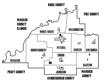


East Gibson in green
North Gibson in red
South Gibson in Maroon


