Gippsland
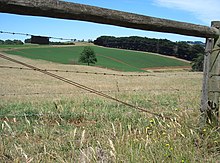
Gippsland (/ˈɡɪpslænd/)[1] is a rural region in the southeastern part of Victoria, Australia,[2] mostly comprising the coastal plains south of the Victorian Alps (the southernmost section of the Great Dividing Range).
It covers an elongated area of 41,556 km2 (16,045 sq mi) east of the Shire of Cardinia (Melbourne's outermost southeastern suburbs) between Dandenong Ranges and Mornington Peninsula, and is bounded to the north by the mountain ranges and plateaus/highlands of the High Country (which separate it from Hume region in Victoria's northeast), to the southwest by the Western Port Bay, to the south and east by the Bass Strait and the Tasman Sea, and to the east and northeast by the Black–Allan Line (the easternmost section of the Victoria/New South Wales state border).
At the 2016 Australian census, Gippsland had a population of 271,266, with the principal centres Traralgon, Warragul, Drouin, Bairnsdale, Moe, Sale, Morwell, Wonthaggi, Leongatha, and Phillip Island.
Before permanent European colonisation, the area was visited by sealers and wattle bark gatherers who did not settle[citation needed].
The climate of Gippsland is temperate and generally humid, except in the central region around Sale, where annual rainfall averages around 600 millimetres (24 in).
In lower levels east of the Snowy River, mean annual rainfall is typically about 900–950 millimetres (35–37 in) and less variable than in the coastal districts of New South Wales.
However, in winter, mean minima in these areas can be as low as −4 °C (25 °F), leading to heavy snowfalls that often isolate the Errinundra Plateau between June and October.
[citation needed] The soils in Gippsland are generally very infertile, being profoundly deficient in nitrogen, phosphorus, potassium and calcium.
Gippsland possesses very few deposits of metallic minerals (gold rushes in the nineteenth century around Foster, Buchan petered out quickly).