Glacier Noir
The great majority of the rubble that covers the lower section of the glacier is transported from its northern branch.
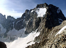
The arête, which runs over these peaks eastwards to Mont Pelvoux, is also called the Grand Muraille du Glacier Noir.
[3][5] Currently the combined tongue of ice flows from its junction, descending another good 200 metres in height, and ends beneath the northern foothills of Mont Pelvoux.
It is about 400 metres wide at this point and a high and steep lateral moraine towers over it on the left-hand (northern) side, across which a climbing path runs from the Pré de Madame Carle, above the village of Ailefroide.
[1] The glacier may be easily reached on foot from the hut of Refuge Cézanne at the Pré de Madame Carle, where the road from the climber's village of Ailefroide ends in the Vallouise at a large car park.
After the retreat of the glacier, vegetation gradually returned on the flat river meadows and created the majestic landscape of the Pré de Madame Carle.