Golden Chersonese
The earliest references to a fabulous land of gold that could be interpreted as places in Southeast Asia may be found in Indian literature.
In the Ramayana, there are mentions of Suvarnabhumi (Land of Gold) and Suvarnadvipa (the Golden Island or Peninsula, where dvipa might refer to either a peninsula or an island)[2][3] Greek knowledge of lands to their east improved after the conquests of Alexander the Great, but specific references to places in Southeast Asia did not appear until after the rise of the Roman Empire.
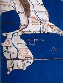
Greek and Roman geographers Eratosthenes, Dionysius Periegetes, and Pomponius Mela had written about a Golden Isle (Khrysē, Chryse Insula),[4][5] which some in modern times have argued refers to Sumatra while excluding the Malay Peninsula.
Arab geographers were aware that the idea of the Indian Ocean as a closed basin was a mistake by the 8th century, for example in the work of al-Khwārizmī, Book of the Description of the Earth.
It has however been suggested that this might be an indication of the existence of an ancient transpeninsular route that linked Perak and Pahang, a short cut between the east and west coasts of the Malay Peninsula.