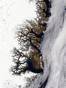
Grandjean Fjord
This fjord was mapped in 1932 during the Three-year Expedition to East Greenland led by Lauge Koch.
Koch named it after Commander Emil Valdemar Asger Grandjean (1889–1948), then chief of the Royal Danish Navy Air Service[1] Grandjean Fjord opens to the east, between Cape Negri to the south and Cape Buch to the north.
Its mouth is located in the northwestern area of Hochstetter Bay, by the northern entrance of Fligely Fjord, northwest of Kuhn Island and south of the mouth area of Ardencaple Fjord.
[1] Ulla Island rises in the middle of mouth area of the fjord, about 7 kilometres (4.3 mi) from the entrance.
Grandjean Fjord separates Thomas Thomsen Land in the south from C. H. Ostenfeldland to the north.