Gregory Point
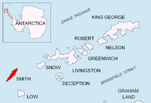
Gregory Point is a rocky point on the northwest coast of Smith Island in the South Shetland Islands, Antarctica projecting 700 m into Drake Passage.
Situated 12.85 km west-southwest of Cape Smith, 3.9 km northwest of Mount Pisgah and 2 km north-northeast of Markeli Point.
The point was roughly charted by Captain Henry Foster in 1829 and named Cape Gregory.
This Smith Island (South Shetland Islands) location article is a stub.
You can help Wikipedia by expanding it.