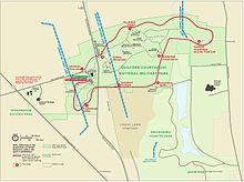
Guilford Courthouse National Military Park
Based on research of historical evidence, the interpretation of the battle has changed since the late 20th century, which will affect the placement of monuments and markers.
In 1886, local resident David Schenck initiated plans to gain control of the land to commemorate the Guilford Courthouse battleground as a park.
When the US Congress finally established Guilford Courthouse as a national military park in 1917, the GBGC turned over its 125 acres (0.51 km2) at no charge.
Before the grounds were established as a military park, state historical societies began to erect monuments in the area purchased by the GBGC.
[citation needed] Since his time, the expanding city of Greensboro approached and encircled the park with private development, destroying some battlefield areas.