Gulf of Maine
The region's glaciation by the Laurentide Ice Sheet stripped sedimentary soil away from the coastline,[3] leaving a shore that is predominantly rocky and scenic, lacking the sandy beaches found to the south along the Eastern Seaboard.
A secondary, shallower connection to the rest of the Atlantic is the Great South Channel, located between Georges Bank and the Nantucket Shoals.The watershed of the gulf encompasses an area of 69,000 square miles (180,000 km2), including all of Maine, 70% of New Hampshire, 56% of New Brunswick, 41% of Massachusetts, and 36% of Nova Scotia.
Significant rivers that drain into the Gulf include, from east to west, the Annapolis, Shubenacadie, Salmon, Petitcodiac, Saint John, Magaguadavic, St. Croix, Penobscot, Kennebec, Saco, Piscataqua, Merrimack and Charles rivers; the Saint John and Penobscot have the greatest discharge.
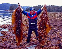
[6] Alongside this decline, the kelp beds have been replaced by invasive turf, defined as macroalgae that provide little three-dimensional structure but form on the bottom layers as filaments, branches, or plumes.
[10] This, along with past overfishing, has helped push stocks towards collapse and hampered its recovery despite deep reductions in the number of fish caught, according to a study conducted by the Gulf of Maine Research Institute.
[11] Starting in the early 1990's, to prevent further degradation of the ecosystem, a number of closed areas have been created in which certain activities are banned for some or all parts of the year.
[12] The gulf's relative proximity to Europe compared to other locations on the opposite side of the Atlantic made it an early destination for European colonization.
[13] In the 1960s and 1970s, there was a dispute between Canada and the United States over fishing and other resource rights in the Gulf of Maine, specifically in the Georges Bank region.
The two nations continue to disagree on the sovereignty of Machias Seal Island and the waters surrounding it in the northeastern part of the gulf.