Ipswich River
The river provided safe harborage at offshore Plum Island Sound to early Massachusetts subsistence farmers, who were also fishermen.
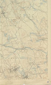
[5] The river begins in the northeastern part of Burlington in northcentral Middlesex County Massachusetts and heading generally southeasterly, it passes through the towns of Wilmington (where once the important Middlesex Canal passed over it on an aqueduct), Reading, thence to North Reading, where it is joined by the left bank tributary Skug River — which originates in North Andover and Andover southwest of Boston Hill in a large Beaver Pond and marshland, situated north of Gray Road-jct.-Gray Street (very near the townlines of the two towns) where it crosses via culvert south of Rt.
MA 114 (historically, and by street name, the Salem Turnpike), and thence, about a mile south, gains volume draining all of Harold Parker State Forest in the tri-town corner of Andover, North Andover, and Middleton — excepting the few acres draining to Ipswich tributary, Boston Brook along the other side of MA 114.
Both tributary creeks enter and mingle with the Ipswich proper in Middleton, proceed south into northern Peabody, then loop northwards through the municipalities of Danvers, Topsfield (crossing US Route 1 just south of the Topsfield Fairground, entering from the west turns northerly and runs the greater length of Teal Pond southwest to north, the east bank of which forms a part of the western border of Hamilton, and exits the lake turning easterly staying south of Ipswich Road to head through and between the Willowdale State Forest and Bradley Palmer State Park, then opens a gap from Ipswich road diverging southeasterly from the road and the south edge of the Turner Hill Golf Club to turn north and form the west border of the Julia Bird Reservation thence meanders north through settled Ipswich neighborhoods and directly through town center passing under MA 133 (County Road, aka.
From Nichols it traverses a bit over 2.5 miles (4.0 km)[6] joins with Plum Island Sound in connecting with the Atlantic Ocean at Ipswich Bay.
There a sharper drop in elevation over some rocky areas upstream characteristic of Northeastern US streams in general and which prevents further navigation without portaging light boats.
The river and riverlands currently suffer from diminished flow due to extensive withdrawals from the ground water in urban areas upstream.
The combined Ipswich River/Plum Island Sound exits through a relatively narrow, shallow channel that passes under Castle Hill and along Crane's Beach to the south.
Despite these difficulties, the sound and the mouth of the Ipswich were mooring places of ocean-going cargo vessels and fishing and whaling boats, before the opening of Newburyport Harbor, then blocked by a sandbar.

in Ipswich Bay, July 2010