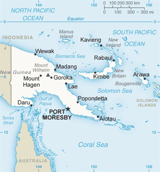
Gulf of Papua
While the western coast is characterized by swampy tidal waterways, land to the east ending at Cape Possession is flat and sandy.
The Papuan Gulf's central and eastern interior slowly rises to meet the mountainous Southern Highlands and is covered in a variety of inland swamps and dense tropical hardwood forests.
It is bordered by a relatively steep delta region in 20–50 m of water, that extends along the coast between the tide-dominated Fly and wave-dominated Purari River mouths.
[2] The incised valley zone has a complex, offshore-onshore-trending seafloor topography on the middle to outer shelf between 50 m and 100 m water depth.
Evidence suggests that the largest of these valleys formed by erosive tidal currents during the Pleistocene when the sea level was about 30–50 m below its present position.
[4] Communities inhabiting the Papuan Gulf primarily live in both villages on the shore or coastal mangrove forests, as well as in key regional centers (Kikori, Baimuru, Ihu, Kerema, and Malalaua).
As a result of these demographic shifts, Port Moresby is home to a sizable community of Papuan Gulf residents.
Within the Purari Delta and among the Elema it is common for individuals, particularly men, to travel to Port Moresby at least once a year to see relatives and to earn money.
Today, people primarily rely on fishing and hunting, sago palms, and depending on the area agriculture and horticulture.
Communities (Purari, Urama, Gope, Goaribari, Kerewa) in the west have small inland gardens and tend to focus their cultivation efforts on a variety of fruit and nut-bearing trees.
Since the early 1990s, communities of the Papuan Gulf have experienced intensive localized development by multinational companies in search of oil and revenue found in the region's tropical hardwood forest.
This art is mostly made of wood and is carved in relief and painted with local dyes of red ochre, lime, and coal.