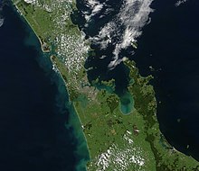
Hauraki Rift
[1] The mountains of the Coromandel (which include andesitic and basaltic back arc volcanoes) and Kaimai Range to the east and the Hunua Range to the west give it the appearance of a full graben although it has also been described as a simple structure of 2 to 3 half-grabens[2] so the term Hauraki Graben for the low lying portions would be incorrect.
The active intra-rift Kerepehi Fault in the southern portion of the Hauraki Rift is complex and has the potential for large earthquakes.
[1] Initially between 10 and 5 million years ago the rift developed in a back arc region to the now extinct Coromandel volcanoes.
[2] To the north the rift is filled with 2.5–3 kilometres (1.6–1.9 mi) thick Tertiary and Quaternary terrestrial sediments and beyond Waiheke Island it opens up into an oceanic basin.
TVZ eruptive output of 240,000 years ago, being Mamaku ignimbrite from the Rotorua caldera has filled in the far southern extremes.