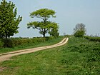
High Dyke (road)
It is also the name of a small settlement on that road, 1 mile (1.6 km) south-east from Great Ponton, near to the mouth of Stoke Tunnel on the East Coast Main Line.
[1][2] Recent rebuilding of the A1 road junction at Woolsthorpe-by-Colsterworth in 2008 has included construction of a grade-separated road crossing in place of the disused railway bridge that was part of the High Dyke branch, a mineral railway used to export iron ore between 1916 and 1973.
There is a right turn for Burton Coggles to the right, and the 18-acre Easton Cold Store,[6] built in the late 1960s, and run by XPO Logistics, formerly Norbert Dentressangle.
From here to almost Ancaster, the road becomes the boundary of several parishes starting with Londonthorpe and Harrowby Without to the left and Old Somerby to the right.
At Duke's Covert (SK979425, 92 m elevation) it meets King Street from Bourne, and the road descends into Ancaster.
It crosses the A153 at traffic lights, and passes under the Poacher Line at Ancaster railway station.
The Viking Way joins from the east, and follows the road, where the boundary is between Normanton to the west, and North Rauceby.
[2] The Line of the Roman Road Continues to the North, still labelled both Ermine Street and High Dike on the OS maps, as the route of the Viking Way.
Just east of Wellingore the alignment turns slightly more to the north at SK994564, and continues past Navenby and Boothby Graffoe to Coleby Mill (SK989600, 75m above sea level).
The alignment is still clear, and to the West of the runways it is used as a housing estate road, before losing its identity south of Bracebridge Heath, around SK981652 still at 75 m high.


This is part of the descent from Stoke Tunnel, where Mallard broke the speed record for Steam Locomotives in 1938. [ 3 ]