Ontario Highway 2
Prior to the 1990s, Highway 2 travelled through many of the major cities in Southern Ontario, including Windsor, Chatham, London, Brantford, Hamilton, Burlington, Mississauga, Toronto, Oshawa, Belleville, Kingston and Cornwall, and many other smaller towns and communities.
Conversely, the importance of Highway 2 for long-distance travel was all but eliminated, and coupled with the increasing suburbanization of the Greater Toronto Area, it became simply a series of urban arterials street between Hamilton and Oshawa.
In 1997 and 1998, the province downloaded 391.6 kilometres (243.3 mi) of Highway 2 and rescinded dozens of Connecting Link agreements, reducing the route to its current length.
Highway 2 begins at the eastern town limits of Gananoque, and travels east a short distance before gently curving northward.
It intersected the southern end of Highway 27 and travelled through the community of New Toronto, where numerous motels flourished during the golden age of the automobile which have since given way to condominium development.
[18][19] Approaching the west bank of the Humber River which was the eastern terminus of the Queen Elizabeth Way until 1998, the Highway 2 route merged onto the Gardiner Expressway via an on-ramp from Lake Shore Boulevard.
Beyond the Don Valley Parkway interchange, the Gardiner descended to ground level and ended, so Highway 2 rejoined Lakeshore Boulevard near Leslie Street.
[18]Prior to the construction of the Gardiner and Lakeshore Boulevard, the original alignment of Highway 2 through Downtown Toronto split into three separate routes to disperse traffic through the core.
[20][21] All three routes rejoined at and followed Kingston Road along the newest pre-1998 alignment.,[22] although after the construction of Lake Shore, the aforementioned later branches along Coxwell and Woodbine Avenues were created.
It continued near the shoreline of Lake Ontario through the town of Cobourg, where it intersected the southern end of Highway 45, as well as the communities of Grafton, Wicklow, Colborne and Salem.
It passed through Cardinal, as well as the Lost Villages relocated towns of Iroquois, Morrisburg—where it intersected Highway 31—Ingleside and Long Sault before entering Cornwall.
While some portions may have existed as trails created by Indigenous peoples for hundreds of years, the first recorded construction along what would become Highway 2 was in late October 1793, when Captain Smith and 100 Queen's Rangers returned from carving The Governor's Road 20 miles (32 km) through the thick forests between Dundas and the present location of Paris.
John Graves Simcoe was given the task of defending Upper Canada (present day Ontario) from the United States following the American Revolution and with opening the territory to settlement.
Danforth's inspector and acting surveyor general William Chewett declared the road "good" for use in the dead of winter, but "impassible" during the wet summers, when the path turned to a bottomless mud pit.
[25] Danforth agreed, but the province insisted otherwise and only four settlers took up residence along the road between Toronto and Port Hope;[26] like many other paths of the day, it became a quagmire.
[31] As the route straying through Scarborough avoided many of the settlers who had taken up residence near the lake, Danforth's road was bypassed by 1814 by William Cornell and Levi Annis.
The Cornell Road (as it was known for a short time) shortened the journey from Victoria Park to West Hill, but remained mostly impassible like Danforth's route to the north.
Downriver from Kingston, roads built along the St. Lawrence for War of 1812 military use became a popular means to avoid rapids on the river by travelling overland.
Prescot, now called Fort Wellington, is important as being the chief stage between this port and Montreal, from which it is distant 130 miles, and between which coaches run every day, except Sundays.
From the position of this place, however, as at the head of the Montreal boat-navigation, and at the foot of the sloop and steam navigation from the lakes, it must soon increase in extent, as it will rise in importance.The creation of a post road extended year-round communication which had already existed on the Chemin du Roy from Quebec City-Montreal westward, with the first stagecoaches reaching York (Toronto) in January 1817.
The original coaches left Montreal every Monday and Thursday, arriving in Kingston two days later; the full Montreal-York run took a week.
[34] As with earlier routes (such as the Danforth Road),[35] coaching inns prospered in every wayside village as the stagecoaches made frequent stops for water, food or fresh horses.
"[38] Despite these issues, this road would remain the principal means of winter travel until the Grand Trunk Railway connected Montreal and Toronto in 1856.
The macadamised Lake Shore Road between Toronto and Hamilton, in poor condition with ongoing erosion, was the first section to be upgraded with concrete.
In 1918, the province subsidised the county and municipal purchase of various former toll roads (Brockville-Prescott, Paris-Brantford, Cobourg-Port Hope and Cobourg-Baltimore) to be improved and incorporated into the provincial highway system.
The 1926 Official Road Map of Ontario boasted the "Highway from Windsor to the Quebec border, via London will all be paved at the end of the present year" and "a person will then be able to travel over 700 miles of pavement without a detour".
While thousands of miles of dirt and gravel road still remained throughout the system, the steel rails which crossed the region now had a credible rival in southern Ontario.
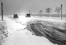
[43] The wartime rationing of the 1940s soon gave way to the fifties neon era of growing prosperity, increased vehicle ownership and annual paid vacations.
Service stations, diners, motels and tourist-related establishments were proliferating on long strips of highway such as Toronto's Lakeshore Boulevard and Kingston Road to accommodate the growing number of travellers.
As the main street in many communities Highway 2 remained busy with stop-and-go local traffic, sustaining countless shopkeepers and restaurateurs but offering little comfort to independent tourist motels.