Toronto
The city is the anchor of the Golden Horseshoe, an urban agglomeration of 9,765,188 people (as of 2021) surrounding the western end of Lake Ontario,[11] while the Greater Toronto Area proper had a 2021 population of 6,712,341.
[13][14][15] Indigenous peoples have travelled through and inhabited the Toronto area, located on a broad sloping plateau interspersed with rivers, deep ravines, and urban forest, for more than 10,000 years.
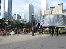
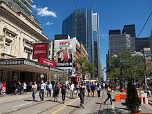
[30] Its varied cultural institutions,[31] which include numerous museums and galleries, festivals and public events, entertainment districts, national historic sites, and sports activities,[32] attract over 43 million tourists each year.
During the American Revolutionary War, an influx of British settlers arrived there as United Empire Loyalists fled for the British-controlled lands north of Lake Ontario.
Simcoe decided to move the Upper Canada capital from Newark (Niagara-on-the-Lake) to York,[57] believing the new site would be less vulnerable to attack by the United States.
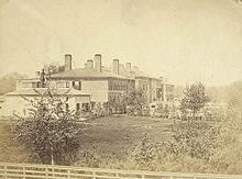
In the 1840s, an eating house at Frederick and King Streets, a place of mercantile prosperity in the early city, was operated by a black man named Bloxom.
The Scottish and English population welcomed smaller numbers of Protestant Irish immigrants, some from what is now Northern Ireland, which gave the Orange Order significant and long-lasting influence over Toronto society.
[67] In the 19th century, the city built an extensive sewage system to improve sanitation, and streets were illuminated with gas lighting as a regular service.
The advent of the railway dramatically increased the numbers of immigrants arriving, commerce and industry, as had the Lake Ontario steamers and schooners entering port before.
During this time, in part owing to the political uncertainty raised by the resurgence of the Quebec sovereignty movement, many national and multinational corporations moved their head offices from Montreal to Toronto and Western Canadian cities.
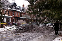
[78] Lastman gained national attention after multiple snowstorms, including the January Blizzard of 1999, dumped 118 centimetres (46 in) of snow and effectively immobilized the city.
[100] The Wychwood Park neighbourhood, historically significant for the architecture of its homes, and for being one of Toronto's earliest planned communities, was designated as an Ontario Heritage Conservation district in 1985.
[citation needed] East and west of downtown, neighbourhoods such as Kensington Market, Chinatown, Leslieville, Cabbagetown and Riverdale are home to bustling commercial and cultural areas as well as communities of artists with studio lofts, with many middle- and upper-class professionals.
[citation needed] Other neighbourhoods in the central city retain an ethnic identity, including two smaller Chinatowns, the Greektown area, Little Italy, Portugal Village, and Little India, among others.
Upscale neighbourhoods were built, such as the Bridle Path in North York, the area surrounding the Scarborough Bluffs in Guildwood, and most of central Etobicoke, such as Humber Valley Village, and The Kingsway.
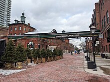
[citation needed] In the 1800s, a thriving industrial area developed around Toronto Harbour and the lower Don River mouth, linked by rail and water to Canada and the United States.
Examples included the Gooderham and Worts Distillery, Canadian Malting Company, the Toronto Rolling Mills, the Union Stockyards and the Davies pork processing facility (the inspiration for the "Hogtown" nickname).
In the west end of Old Toronto and York, the Weston/Mount Dennis and The Junction areas still contain factories, meat-packing facilities and rail yards close to medium-density residential.
In contrast, since 2000, amid the Canadian property bubble, Toronto has experienced a condo construction boom and architectural revival, with several buildings opened by world-renowned architects.
[154] According to the United Nations Development Programme, Toronto has the second-highest percentage of constant foreign-born population among world cities, after Miami, Florida.
[158] This diversity is reflected in Toronto's ethnic neighbourhoods, which include the Chinatowns, Corso Italia, Greektown, Kensington Market, Koreatown, Little India, Little Italy, Little Jamaica, Little Portugal and Roncesvalles (Polish community).
The city's strategic position along the Quebec City–Windsor Corridor within the Great Lakes megalopolis and its road and rail connections help support the nearby production of motor vehicles, iron, steel, food, machinery, chemicals and paper.
Toronto is Canada's largest media market,[176] and has four conventional dailies, two alt-weeklies, and three free commuter papers in a greater metropolitan area of about 6 million inhabitants.
[183] Toronto is home to a large startup ecosystem and is the third-largest center for information and communications technology in North America, behind New York City and the Silicon Valley.
Ontario Place features the world's first permanent IMAX movie theatre, the Cinesphere,[233] as well as the Budweiser Stage (formerly Molson Amphitheatre), an open-air venue for music concerts.
As of 2011, Toronto ranks as the third-largest production centre for film and television after Los Angeles and New York City,[235] sharing the nickname "Hollywood North" with Vancouver.
[271] The games were the largest multi-sport event ever to be held in Canada (in terms of athletes competing), double the size of the 2010 Winter Olympics in Vancouver, British Columbia.
[280][281][282] For instance, in 2007, the homicide rate for Toronto was 3.43 per 100,000 people, compared with Atlanta (19.7), Boston (10.3), Los Angeles (10.0), New York City (6.3), Vancouver (3.1), and Montreal (2.6).
[295][296] The 2018 homicide rate was higher than in Winnipeg, Calgary, Edmonton, Vancouver, Ottawa, Montreal, Hamilton, New York City, San Diego, and Austin.
Downsview Airport (IATA: YZD), near the city's north end, is owned by de Havilland Canada and serves the Bombardier Aviation aircraft factory.