Trail
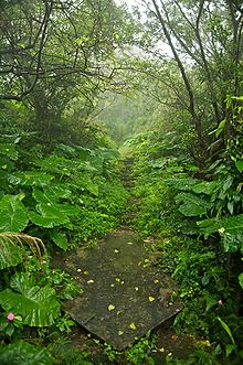
A trail, also known as a path or track, is an unpaved lane or a small paved road (though it can also be a route along a navigable waterways) generally not intended for usage by motorized vehicles, usually passing through a natural area.
In Australia, the term track can be used interchangeably with trail or walk, and can refer to anything from a dirt road to an unpaved pedestrian path.
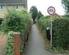
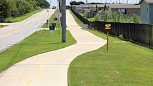
Generally, the term footpath is preferred for pedestrian routes, including long-distance trails, and is used for urban paths and sometimes in place of pavement.
[8] Subsequently, farmers moved cattle to market along drove roads and between winter and summer grazing creating trails.
The Post Track, a prehistoric causeway in the valley of the River Brue in the Somerset Levels, England, is one of the oldest known constructed trackways and dates from around 3838 BC.
[11] The idea of following a path or track for exercise or pleasure developed during the 18th century in Europe and arose because of changing attitudes to the landscape and nature associated with the Romantic movement.
The first footpath built specifically for recreational hiking in America, and likely the world, is the Crawford Path in the White Mountains of New Hampshire.
Some skiers stay out for extended periods using tents and equipment similar to bushwalkers and hikers, whereas others take shorter trips from ski resorts on maintained trails.
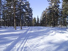
For example, the Norwegian Mountain Touring Association maintains over 400 huts stretching across hundreds of kilometres of trails hikers use in the summer and skiers use in the winter.
[28] This trail runs the length of the rugged Great Dividing Range through national parks, private property and alongside of wilderness areas.
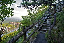
They include: signs and route markers; maps; facilities for parking, boat ramps or docks, and places to camp and picnic.
The Trans Canada Trail can be used by cyclists, hikers, horseback riders, and walkers, as well as cross-country skiers, snowmobilers and snowshoers in winter.
[56] The seawall in Stanley Park, Vancouver, British Columbia, Canada is popular for walking, running, cycling, and inline skating.
[57] Foreshoreway (also oceanway) is a term used in Australia for a type of greenway that provides a public right-of-way along the edge of the sea open to both walkers and cyclists.
[59] The commission works with associations involved in rambling, cycling, mountain biking and horse riding to promote the use of its land for recreation.
A notable example of the commission's promotion of outdoor activity is the 7stanes project in Scotland, where seven purpose built areas of mountain bike trails have been laid, including facilities for disabled cyclists.
RailTrails Australia describes them as:Following the route of the railways, they cut through hills, under roads, over embankments and across gullies and creeks.
Apart from being great places to walk, cycle or horse ride, rail trails are linear conservation corridors protecting native plants and animals.
In the USA the 42 mi (68 km) Cheshire Rail Trail, in New Hampshire, can be used by hikers, horseback riders, snowmobilers, cross-country skiers, cyclists, and even dogsledders.
[67] Ten years later British Waterways started to relax the rule that a permit was required to give access to a towpath, and began to encourage leisure usage by walkers, anglers and in some areas, cyclists.
Similar paths also exist in some older North American towns and cities, like Charleston, South Carolina, New Castle, Delaware, and Pittsburgh, Pennsylvania.
The Countryside and Rights of Way Act 2000 provides that paths that are not recorded on the definitive map by 2026 and that were in use prior to 1949 will automatically be deemed stopped-up on 1 January 2026.
There is no legal distinction between footpaths and bridleways in Scotland, as there is in England and Wales, though it is generally accepted that cyclists and horseback riders may follow rights of way with suitable surfaces.
The Appalachian Trail is a marked hiking route in the eastern United States extending between Springer Mountain, Georgia, and Mount Katahdin, Maine.
[101] All trails and shared use paths—indeed, any areas open to pedestrians—that are owned or operated by a public or private entity covered by the Americans with Disabilities Act of 1990 are subject to federal regulations on Other Power-Driven Mobility Devices ("OPDMDs").
These rules potentially greatly expand the types of vehicular devices that must be permitted on trails, shared use paths, other routes, and other areas open to the public.
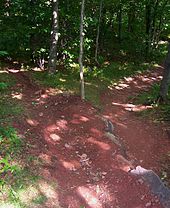
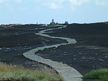
[103] While most trails have arisen through common usage, the design and construction of good quality new paths is a complex process that requires certain skills.
This type of trailway is created by establishing a line of a suitable slope across a hillside, which is then dug out by means of a mattock or similar tool.
This may be a full-bench trail, where the treadway is only on the firm ground surface after the overlying soil is removed and sidecast (thrown to the side as waste), or a half-bench trail, where soil is removed and packed to the side so that the treadway is half on firm old ground and half on new packed fill.
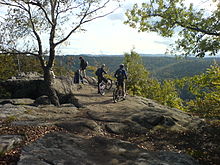
[108] A well designed recreational mountain bike path for the exclusive use of bicycles has an average grade of less than 10% and generally follows a contour line, rather than straight downhill.


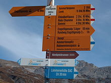
mountain path in white-red-white,
Alpine Route in white-blue-white