History of Atlantic hurricane warnings
After his death, hurricane warning services were assumed by the US Army Signal Corps and United States Weather Bureau over the next few decades, first based in Jamaica and Cuba before shifting to Washington, D.C.
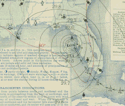
The first hurricane warning service was set up in the early 1870s from Cuba with the work of Father Benito Vines, who served as director of the Meteorological Observatory of the Royal College of Belén.
[3] The United States Congress passed a bill to authorize the establishment and operations of weather stations across the West Indies and Caribbean Sea on July 7, 1889.
[8] However, no Coast Guard cutters ever penetrated a full hurricane as part of this patrol and the idea of using aircraft was moth-balled until 1943.
In the case of tropical cyclones, the civilian and military warning agencies maintained close coordination.
[18][19] This was when hurricane reconnaissance planes were sent out to fly across the Atlantic and Gulf of Mexico on a routine basis to look for potential tropical cyclones, in the years prior to the continuous weather satellite era.
Robert Simpson, a Weather Bureau meteorologist who had participated in Air Force hurricane reconnaissance flights as an observer, was appointed as the first director of NHRP and organized the Research Operations Base at Morrison Air Force Base (now Palm Beach International Airport) in West Palm Beach, Florida in 1956.
The Department of Commerce leased two DC-6 aircraft and received a B-57 jet from the Air Force so that NHRP could continue to carry out airborne experiments on hurricanes.
During the 1960s, while NHRP continued to carry out research flights, the Project also began to create computer models of hurricane circulation, formulated a statistical track program (NHC-64), wrote a manual on hurricane forecasting, and evaluated the accuracy of track forecasts.
Late in 1964, the Project was renamed the National Hurricane Research Laboratory in recognition of it becoming a permanent institution within the Weather Bureau.
[24] The Miami Hurricane Warning Office (HWO) was moved from Lindsey Hopkins Hotel to the Aviation Building 4 miles (6.4 km) to the northwest on July 1, 1958.
[26] In 1970, NHC began analyzing tropical cyclone initial positions in real-time and added a 12‑hour forecast.
[12] During the National Weather Service reorganization in the 1990s, the NHC was renamed the Tropical Prediction Center on October 1, 1995,[31] and moved into a building on the campus of Florida International University.
Three main classes of tropical cyclone guidance models exist: statistical models are based on an analysis of storm behavior using climatology and correlate a storm's position and date to produce a forecast that is not based on the physics of the atmosphere at the time.
[36] Within the field of tropical cyclone track forecasting, despite the ever-improving dynamical model guidance which occurred with increased computational power, it was not until the 1980s when numerical weather prediction showed skill, and until the 1990s when it consistently outperformed statistical or simple dynamical models.
Small craft, gale, and storm warnings were issued for hurricanes not expected to make landfall.
[43] Within the United States, a separate set of inland tropical cyclone warnings was issued by National Weather Service forecast offices, based upon the latest NHC advisory, during the decade of the 2000s.
When they were inland, watches and warnings were posted for a tropical storm or hurricane-force winds expected during the next 24 and 12 hours, respectively.
If systems occur outside the defined hurricane season, special Tropical Weather Outlooks will be issued.
Tropical cyclone watches and warnings are coordinated within the countries and dependencies involved, with the National Hurricane Center coordinating with National Weather Service Forecast Offices concerning storms threatening the United States and its dependencies.