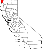
Crescent City, California
The city is also the site of the Redwood National Park headquarters, as well as the historic Battery Point Light.
Due to the richness of the local Pacific Ocean waters and the related catch, and ease of access, Crescent City Harbor serves as home port for numerous commercial fishing vessels.
The city is on the Pacific coast in the upper northwestern part of California, about 20 mi (32 km) south of the Oregon border.
In 2011 the city's harbor suffered extensive damage and destruction from tsunamis generated by the March 11, 2011, earthquake off Sendai, Japan.
Several dozen vessels and many of the docks they were moored to were destroyed as wave cycles related to the tsunamis exceeded 8 ft (2.4 m).
[11] In 1855, the U.S. Congress authorized the building of a lighthouse at "the battery point" (a high tide island on the coast of Crescent City) which is still functioning as a historical landmark.
Due to the richness of the local Pacific Ocean waters and the related catch, and ease of access, Crescent City Harbor serves as home port for numerous commercial fishing vessels.[when?
[16] Two notable shipwrecks happened off the coast, in 1865 and then at the start of World War II in December 1941, when a Japanese submarine hit a US oil tanker.
The Brother Jonathan, a paddle steamer, crashed on an uncharted rock near Point St. George, off the coast of Crescent City, California, on July 30, 1865.
Its nearest Californian place of any size to its interior is Happy Camp separated by roughly 42 mi (68 km) by air, but, due to the unsuitable terrain, it is much farther by road.
Crescent City is as far north in latitude as Chicago, Middle Island in Ontario, Canada, as well as New England on the Atlantic side.
The coldest daytime temperature was 30 °F (−1 °C) in 1924, which remains the last time Crescent City did not climb above the freezing point for 24 hours.
"[24] On March 27, 1964, the Great Alaskan earthquake off Anchorage, Alaska, set in motion local landslide tsunamis, as well as a trans-Pacific wave.
The tsunami wave travel time to Crescent City was 4.1 hours after the earthquake, but it only produced localized flooding.
Insurance adjusters estimated that the city received more damage from the tsunami on a block-by-block basis than did Anchorage from the initial earthquake.
[27] Although houses, buildings, and infrastructure were later rebuilt, years passed before the city recovered from the devastation to lives, property, and its economy.
Since the 1980s, the breakwater has been protected from normal storm waves by hundreds of Dolos armor units, 38 ton concrete shapes.
Its preparedness was tested on June 14, 2005, when the 2005 Eureka earthquake measuring 7.2 on the moment magnitude scale hit 90 mi (145 km) offshore; much of the city (an estimated 6,000 people)[29] was evacuated when a tsunami warning was issued, and a 26 cm (10 in) tsunami wave hit the area.
However, a surge from that quake did hit the harbor at Crescent City causing damage to three docks and several boats.
The very high institutionalized percentage is a result of the presence of Pelican Bay State Prison, which was annexed into the city limits in the 1990s.
Highway access is provided by U.S. Route 101, which runs directly through the city, connecting the Oregon Coast to the north and Eureka to the south.
U.S. Route 199 begins north of Crescent City and runs northeast to Grants Pass, Oregon.
SkyWest Airlines formerly served Del Norte County Airport (also known as Jack McNamara Field) as United Express until April 7, 2015.