History of El Paso, Texas
Archeological evidence at the Keystone Wetlands and Hueco Tanks sites indicates thousands of years of human settlement within the El Paso region.
These people ultimately became assimilated into the local settler population, becoming part of the Mestizo culture that is prevalent in Mexico and is visible throughout the Southwest.
Juan de Oñate, born in present-day Zacatecas, Zacatecas, Mexico, was the first explorer to arrive at the Rio Grande near El Paso (near the current small town of San Elizario, which is about 30 miles (48 km) downstream of El Paso), where he ordered his expedition party to rest and where the official act of possession, La Toma, was executed and celebrated, on April 30, 1598.
From El Paso, the Spaniards led by Diego de Vargas, grouped once again to recolonize the precious Spanish territory that was centered in Santa Fe and stretched from Socorro (New Mexico) to the areas that included Taos.
Historical records[specify] indicated that the first permanent agricultural enterprise north of the Río Grande located in present-day El Paso was the Ponce de León Ranch, on land granted in 1825.
Consequently, present-day Juárez remained the northernmost villa with the Río Bravo del Norte, and Apache attacks dissuading settlement and development north.
The water of the river, the sand dunes to the south (médanos), and the fortifications at Paso del Norte and El Real de San Lorenzo provided a natural defense against further raids; however, in some decades, several-thousand-strong Apache armies made raids deep into Mexico, slaughtering the male population and enslaving women and children.
[3] Although there was no combat in the region during the Mexican Independence, Paso del Norte experienced the negative effects it had on the trade of its wines and produce that kept the town alive.
[citation needed] The present Texas-New Mexico boundary, placing El Paso on the Texas side, was drawn in the Compromise of 1850.
[7] El Paso was incorporated in 1873 and encompassed the small area communities that had developed along the river (Magoffinsville, Concordia, Hart's Mill).
With a tempting green valley and a nearly perfect climate year-around, the town attracted a constant stream of newcomers, including many merchants, entrepreneurs, and professionals who came to the region to benefit from the Mexican Free Trade zone.
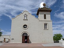
The American Catholic hierarchy gradually exerted control over the El Paso Valley, sending out Jesuit priests who developed a network of parishes and schools over the 1880s–1910s.
A native of southern Italy, Pinto arrived in Northern New Mexico and Colorado in the 1870s, working there until he was assigned to El Paso ca.
Some historians, like Leon Metz, have stressed in their narratives the lawlessness that accompanied the arrival of Anglos, with "scores of saloons, dance halls, gambling establishments, and houses of prostitution lin[ing] the main streets.
[13][full citation needed] Over time, two small settlements developed around the smelter, acquiring the Hispanicized name "La Esmelda", or "Smeltertown".
Prostitution and gambling flourished until World War I, when the Department of the Army pressured El Paso authorities to crack down on vice.
Moore discovered a man holding a concealed palm pistol standing at the El Paso Chamber of Commerce building along the procession route.
El Paso became a center of intrigue as various exiled leaders including Victoriano Huerta and (for a time) Pancho Villa were seen in the city.
A significant Mexican middle class population developed cultural, social, and educational institutions catering to their needs, including many located in central El Paso and in the Sunset Heights area.
They staffed parishes like Santo Angel, San Ignacio, and Sagrado Corazón in South El Paso and the Sagrada Familia, in Sunset Heights, as well as a chapel in Smeltertown.
South El Paso street was the premier artistic and cultural center of Mexican El Paso, with over a dozen cinemas and theaters that featured the latest films, as well as vaudeville performers, tandas skits, carpas comics, nightclubs, and the occasional touring Spanish-language theatrical and opera company, such as that of the grande dame of the Mexican stage, Virginia Fábregas.
Around the start of the 20th century, bilingual interpreters called out in Spanish the English-language text of American movies, and this gradually gave way to on-screen translations.
However, given the city's proximity to Juarez, where nightclubs, dance halls and gambling dens flourished in the 1920s and where alcohol remained legal, El Paso would become a major hub in the illicit liquor trade during both state and nationwide prohibition.
Between 1920 and 1933, there were perhaps hundreds of shootouts between area lawmen and smugglers in and around El Paso resulting in the deaths of numerous local and federal officers and countless bootleggers.
Simultaneously, the narcotics trade along the Rio Grande also flourished, setting the stage for the drug wars that would plague the region in the decades to come.
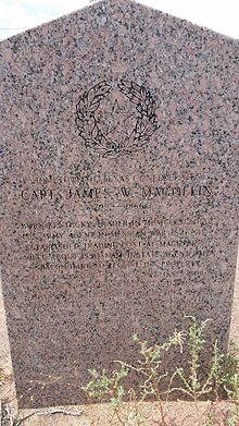
His story is best captured in an October 1973 Texas Monthly article "The Man Who Invented the Margarita" by Brad Cooper, and later in his obituary in the Washington Post on January 2, 1997.
The expansion of Fort Bliss from a frontier post to a major Cold War military center brought in thousands of soldiers, dependents, and retirees.
In 1963, the U.S. agreed to cede Chamizal, a long-disputed part of El Paso, to Mexico due to changes in the course of the Rio Grande, which forms the international boundary between the two countries.
Since 1990, the local economy has been adversely affected by competition with low wage labor abroad, and the closure of the main copper smelter due to fluctuating metal prices, and excessive lead contamination found throughout many of the surrounding areas.
The implementation of the North American Free Trade Agreement in 1994 affected the local economy, with transport, retail, and service firms expanding, and the accelerated loss of many industrial jobs.