History of Randolph, Tennessee
Randolph is an unincorporated rural community in Tipton County, Tennessee, United States, located on the banks of the Mississippi River.
The lands of the Mississippi River Basin were inhabited by Paleo-Indians and later Native American tribes of the Mississippian culture for thousands of years.
The Tipton phase people and the Chickasaw Indian tribe populated the Mississippi River valley near Randolph during the Mississippian period.
The fortunes of the community began to decline in the late 1840s due to failed railroad development, an unfavorable mail route and an unsuccessful attempt to move the county seat from Covington to Randolph.
The park is intended to promote the Civil War history of the community and make the unique views of the Mississippi River available to a wider public.
From about 10,000 BCE, Paleo-Indians and later Archaic-Indians lived as communities of hunter-gatherers in the area that covers the modern day southern United States.
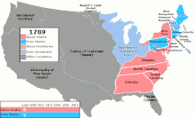
In 1818, Judge John Overton wrote to General James Winchester that "We must not let the owners of the property on the Bluffs at the Mississippi above us be beforehand in laying off town—as it might damp the sale of ours".
In the early 19th century, the terrain of the Chickasaw Bluffs provided promising locations for a harbor on the Mississippi River for both emerging towns.
[23] Early in the 1820s, landowners and investors John T. Brown and Robert Bedford were the proprietors of the land on the second Chickasaw Bluff that would form Randolph a few years later.
Only 40–50 miles (60–80 km) north of Memphis by water, they described the area as "a good landing for Mississippi River flatboats".
Brown and Bedford chose the site on the second Chickasaw Bluff to lay out the plan for Randolph, a promising river town.
The route provided a link between the two flourishing towns and connected the settlements on the banks of the Mississippi River in Tipton and Shelby Counties for trade and travel purposes.
[9] A good part of the commercial success of Randolph can be attributed to the use of slaves working the cotton fields of the area for their owners.
The Tipton County jail also published "jailer's notices" in the Randolph Recorder to inform owners of a slave of their incarceration.
When the mail route was established in 1829, it went from Nashville to Jackson, Bolivar, Somerville, Raleigh and ended in Memphis, but Randolph was left out.
[24][28] Early in the Civil War, in March 1862, the town of Randolph is described as consisting of "half a dozen or so dilapidated frame houses".
[41] In a communiqué sent to LeRoy P. Walker, the first Confederate States Secretary of War, Brigadier General Gideon J. Pillow endorsed Randolph on April 26, 1861 as "the most eligible situation for a battery to protect Memphis".
[42] Within a few days, in late April of that same year, Tennessee Governor Isham G. Harris ordered to establish a camp at Randolph and complete the fortification.
It took four months to fortify the bluff at Randolph with earthen defenses and artillery batteries in order to protect the fort from land and naval attacks.
[37] Fort Wright was the forwardmost defensive position on the Mississippi River until July 1861, it was abandoned by the Confederate infantry by 1862 but sporadically occupied by other southern forces during the Civil War.
[46] In a dispatch published by the New York Times in March 1862, Fort Randolph is described as a "rough and incomplete earthwork (...) more than 100 feet above the river".
[48] Frustrated with raids by guerrillas and with the civilians who aided them, Major General Sherman ordered Colonel Charles C. Walcutt of the 46th Ohio Infantry to Randolph.
"[49] Union Army soldiers under Colonel Walcutt's command burned Randolph in retaliation for the guerrilla activities emerging from the area.
The route went through Jackson, Bolivar, Somerville, Arlington and Raleigh to deliver mail to the post offices in these towns three times per week.
The road was part of a mail line that started in Jackson, it was routed through Brownsville, Covington and Randolph and terminated in Memphis.
The southernmost segment of the mail route provided a direct link between Memphis and Randolph and connected the villages on the Mississippi River along the way for travel and trade purposes.
The land on which the historic mail route was located is used as an industrial property in 2010 and is owned by the Fullen Dock & Warehouse Company.
The Tennessee Encyclopedia of History and Culture dates the beginning of construction work at Fort Wright to late April 1861 and states that over "the next four months" the location was fortified with "artillery batteries and earthen field defenses".
[37] According to Konstam et al. (American Civil War fortifications), the Louisville Weekly Journal reported on June 11, 1861 about Fort Wright that at Randolph there were "50 cannon" present and that "thirty-two of them are monuted".
Only one "narrow defile on the landward side" was reported by the Bulletin which was "defended by heavy guns" and "crossed by an earthen wall thirty to forty feet in thickness" (10–12 m).