History of the East Riding of Yorkshire
The East Riding of Yorkshire is a local government district with unitary authority status, and is a ceremonial county of England.
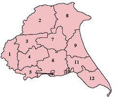
Urban districts were Cottingham, Great Driffield, Filey, Hessle (from 1899), Hornsea, Norton, Pocklington and Withernsea (from 1898).
[5] Bridlington obtained municipal borough status in 1899, having become a resort town (as had Hornsea and Withernsea), although not matching the population growth of Scarborough further up the coast in the North Riding.
The ceremonial county, the area in which the Lord Lieutenant of the East Riding of Yorkshire represents the Crown, was re-established the same day, covering Hull as well as the district.
The Yorkshire Wolds form an upland arc of chalk hills stretching from Flamborough head on the coast to the Humber Estuary at its southern end.
In 1992, a small barbed antler harpoon point was found lodged in a preserved log, thought to be either birch or rowan.
In the Yorkshire Wolds there are thousands of Iron Age square barrows and hundreds of farmsteads and settlements, droveways, tracks and field systems.
[11] The Yorkshire Wolds has a wide range of favourable natural resources and so became a major focus for human settlement during the Neolithic period.
Two of the most recently excavated earthen long barrows in the region are to be found at Fordon, on Willerby Wold, and at Kilham, both of which have provided radiocarbon dates of around 3,700 BC.
An extensive Neolithic ritual complex, the principal elements of which are four large cursus monuments and a henge, is situated near the eastern end of the Great Wold Valley.
[12] More than 1,400 Bronze Age round barrows, are known to exist on the Yorkshire Wolds, occurring either in isolation or, more usually, grouped together to form cemeteries.
In the Iron Age the distinctive local tradition known as the Arras Culture emerged and was named after the type-site, found near Market Weighton, and excavated in 1815–17.
[15] A boat found at North Ferriby, near Kingston upon Hull, has been dated as 2030 BC, which makes it the oldest of its kind in western Europe.
The Ferriby Boats were a means by which ideas, such as the decorative design of pottery, and goods such as Baltic amber and metals could arrive on the Humber shore.
In Holderness the extensive Lordship was granted by King William I of England to Drogo de la Beuvirere, a Flemish follower.
Other large landowners in the area included the abbeys of Meaux and Thornton and the priories of Swine, Nunkeeling and Bridlington.
These ecclesiastical estates were confiscated and became crown property when King Henry VIII of England dissolved the monasteries in the 16th century.
The two major settlement zones are, the Great Wold Valley villages, such as Helperthorpe, Weaverthorpe, Butterwick, Foxholes, Burton Flemming and Rudston, and the east-facing slope of the Wolds including villages such as Carnaby, Haisthorpe, Thornholme, Burton Agnes, and Nafferton, all of which are sited so as to take advantage of a ration of both heavier and lighter agricultural soils.