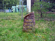
Hohe Derst
The Hohe Derst is a hill, 561 metres above sea level, in the Palatine Forest of southwest Germany.
It lies within the Wasgau region and is the highest point of the Mundat Forest.
The Hohe Derst is situated on the territory of the parishes of Böllenborn and Oberotterbach above the hamlet of Reisdorf, five kilometres east of the town of Bad Bergzabern.
The Landesstraße 492 state road runs around the hill to a walkers' car park.
A military radio-relay tower stands on the Hohe Derst near the Ritterstein marking the summit.
