Hooge in World War I
For much of the war, Hooge was one of the easternmost sectors of the Ypres Salient, being almost constantly exposed to enemy attacks from three sides.
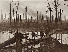
The general aspect south and east of Ypres is one of low ridges and dips, gradually flattening northwards beyond Passchendaele into a featureless plain.
The lowland west of the ridge was a mixture of meadow and fields, with high hedgerows dotted with trees, cut by streams and ditches emptying into canals.
[1] By the end of the battle in November 1914 the Germans had been driven back but the front line of the Ypres Salient ran around Hooge.
[10] On 19 July, the Germans held Hooge Chateau and the British the stables and no man's land either side was 70–150 yd (64–137 m).
Inside the German salient was a fortification under which the 175th Tunnelling Company had dug a gallery 190 ft (58 m) long and charged a mine with 3,500 lb (1,600 kg) of Ammonal but waterlogged ground required the explosives to be loaded upwards.
The area had been suspiciously quiet the night before and at 3:15 a.m. the site of the stables exploded and jets of fire covered the front trenches, the first German flame thrower attack against British troops.
[14] A raid by the 8th Division in II Corps, was made on Hooge on the night of 10/11 July, commanded by Lieutenant-Colonel Roland Haig.
The southern flank then became exposed to the concentrated fire of German machine-guns from Nonne Boschen and Glencorse Wood in the area to be taken by the 30th Division.
It is a significant fact that all their recent attacks round Ypres have been directed on hill tops and have rested content on the same, without trying really hard to advance down the slopes towards us.The tunnellers dug a gallery about 190 ft (58 m) long under the German position and placed a 3,500 lb (1,600 kg) charge.
As Hooge was on the apex of the Ypres Salient, it was considered a most dangerous job and the British command initially relied on volunteers.
(...) Our objective was to sink a shaft, then tunnel under the chateau and annex and blow them up.The work was completed in five and a half weeks.
[18] The Germans tried to recover their lost position but were driven back by the British infantry and a heavy artillery bombardment.
[17] The mine fired by 175th Tunnelling Company at Hooge on 19 July 1915 was only the second British offensive underground attack in the Ypres Salient.
Aerial photographs clearly show the proliferation of mine warfare in the Railway Wood sector during the unit's presence there, with craters lying almost exclusively in no man's land between the British and German trenches.
[21] On the morning of 28 April 1916, a German camouflet killed three men of 177th Tunnelling Company, including an officer (Lieutenant C.G.
On 6 June 1916, the Experimental Company of the Prussian Guard Pioneers succeeded in blowing four large mines under the British trenches at Hooge held by the 28th Canadian Battalion.
[23] The German surprise offensive also captured the neighbouring Observatory Ridge and Sanctuary Wood—the only high ground on British hands in the whole of the Ypres Salient.
It was connected to the mining scheme beneath Railway Wood and eventually became one of the most complex underground shelter systems in the Ypres Salient.
[27] Fighting in the Hooge sector continued until 1918, with the craters (tactically important in relatively flat countryside) frequently changing sides.
[19] Among those killed in the fighting in Hooge was Gerard Anderson, the British hurdler who participated in the 1912 Stockholm Olympics and died in November 1914.
[30] The most visible evidence remaining today is a large pond near the hotel and restaurant at the Bellewaerde theme park.
The site is the result of work overseen by Baron de Wynck, who landscaped three mine craters (blown by German units in June 1916 as part of their offensive against Canadian troops) into the existing pond near the hotel (image Archived 4 March 2016 at the Wayback Machine).
Extensive woodlands, known locally as 'Drieblotenbos Hoge Netelaar' but called 'Sanctuary Wood' by British soldiers who took refuge here in November 1914.