Hydrologic unit system (United States)
[3] As of 2010 there are six levels in the hierarchy, represented by hydrologic unit codes from 2 to 12 digits long, called regions, subregions, basins, subbasins, watersheds, and subwatersheds.
The table below describes the system's hydrologic unit levels and their characteristics, along with example names and codes.
As a result, the subbasin boundaries were changed and adjusted in order to conform to the higher resolution watersheds within them.
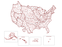
[6] The boundaries of the hydrologic units usually correspond to drainage basins with some exceptions; for example, subregion 1711, called "Puget Sound", includes all U.S. drainage into not only Puget Sound but also the Strait of Georgia, Strait of Juan de Fuca, and the Fraser River.
Nonetheless, hydrologic units and watersheds are commonly treated as synonymous, and this misapplication and misunderstanding can have some serious scientific and management consequences.