Ifrane
Ifrane (Arabic: إفران) is a city in the Middle Atlas region of northern Morocco (population 14,659 as of November 2014).
It is a resort town set high up in the mountains so that Europeans could find relief from the summer heat of the interior plains of Morocco.
[3] The first permanent settlement of the area dates to the 16th century, when the Sharif Sîdî 'Abd al-Salâm established his community in the Tizguit Valley, seven km downstream from the present town.
The first permanent settlement of the area dates to the 16th century, when a sharîf by the name of Sîdî ‘Abd al-Salâm established his community in the Tizguit Valley, seven km downstream from the present town.
Sîdî ‘Abd al-Salâm’s village, called Zaouiat Sidi Abdeslam (or simply the zâwiyah), consisted at first of cave dwellings hollowed out of the limestone valley wall.
By the mid-17th century Sîdî ‘Abd al-Salâm’s zâwiyah was well enough established to receive an extensive iqtâ’, or land grant, from the ‘Alâwî sultan Mûlây Rashîd b. Muhammad.
Late in the 19th century agro-pastoral groups of the Amazigh Senhadja Beni M’guild and Zenata the Ait Seghrouchen, crossing the Middle Atlas from the upper Moulouya Plain, started grazing their herds of sheep and goats on the surrounding plateau.
The agricultural plots were held as private property (mulk) but the grazing land was under collective tribal jurisdiction (j’maa).
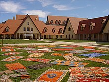
The town was to be a "hill station", a cool place for colonial families to spend the hot summer months, and it was initially planned according to the "garden city" model of urban design then in vogue.
The plan called for chalet-type summer homes in the Alpine style, laid out among gardens and curving tree-lined streets.
The Middle Atlas lies in the center of Morocco and constitutes its natural water tower, as many of the country's most important river systems: the Moulouya, the Sebou, the Bou Regreg, and the Oum Rabia originate in it.
Though the area was regularly crossed by traders, and though the alpine summer pasture was used by herders, the harsh climate and relatively poor soils long impeded permanent human settlement.
A small fort overlooking Oued Tizguit (now part of the palace precinct) had already been built during the period of military conquest in order to secure the Fez to Khenifra road across the mountains.
The gently rolling landscape, with fresh springs and wildflowers, was judged to have potential as a summer resort for colon families from the Saïss Plain, Meknes and Fez.
Fifty hectares of agricultural land upstream from the zâwiyah, in an area originally designated as Tourthit, or "garden", was expropriated for the project.
It is a resort town set high up in the mountains so that Europeans can find relief from the summer heat of tropical colonies.
Ifrane was planned according to the "garden city" model of urban design, fashionable in Western Europe between the two world wars.
They gave the illusion of county life, with village-type architecture, curvy streets and many trees, to people who in reality worked in big cities.
Located in the Atlas Mountains, and affected by the cold Canary current, Ifrane has a continental-influenced hot-summer Mediterranean climate (Csa) with short, somewhat dry, warm summers and long, cool, damp winters.
Because of its elevation, the town experiences snow during the winter months and a cooler climate during the summer (not as hot as in the nearby regions which lie at a lower altitude).
[6] Owing to the city's elevation and proximity to the north Atlantic Ocean, rainfall is very heavy whenever frontal systems affect the region.