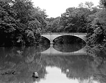
Illinois River (Arkansas–Oklahoma)
In 1828, the river was designated as a main waterway for the Cherokees[5] The Illinois Confederation included the Peoria, Miami, Wei and Kaskaskia tribes.
[6] Lake Tenkiller, created by damming the Illinois River beginning in 1947 with completion in 1953, has attracted tourists and fishermen to this once sparsely settled area.
[5] The spring-fed river rises in the Ozark Mountains in the northwest corner of Arkansas, in Washington County southwest of Fayetteville, near the communities of Hogeye and Onda.
The stream flows north parallel to Arkansas Highway 265 then turns northwest passing under U.S. Route 62 northeast of Prairie Grove.
It continues north-northwest passing under Arkansas Highway 16 west of Savoy and forming a portion of the east boundary of the Ozark–St.
The stream leaves Arkansas at the southwest corner of Benton County and enters Lake Frances in Oklahoma.
It joins the Arkansas River downstream of Gore and upstream of Robert S. Kerr Reservoir, approximately 20 miles (32 km) southeast of Muskogee.
The standard for scenic rivers was set at 0.037 mg/L[4] In December 2003, an agreement was reached between the two states, with Arkansas agreeing to reduce phosphorus output from its waste water treatment plants by 75% over the next ten years, although it does not address poultry-farm runoff.
[10] In the early 2000s, the Illinois River had high levels of pollution due largely to water runoff contaminated by chicken manure.
[11] In 2006, the state of Oklahoma began the process of suing a number of firms, including Tyson Foods Inc. because the chicken waste spread on fields near the river contains chemicals that were injurious to the ecosystem, hence jeopardizing the region's tourist industry.
On October 1, 2015, the U.S. Environmental Protection Agency (USEPA) issued for public comment the water quality model for the Illinois River.