Indonesia–Philippines border
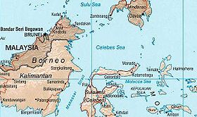
The border between Indonesia and the Philippines consists of a maritime boundary mainly on the Celebes Sea that separates the two Southeast Asian countries as defined through a pact that was signed by both parties in 2014.
[1] The border is also the Exclusive Economic Zone (EEZ) boundary between Indonesia and the Philippines, which is delimited through eight geographic coordinate points.
[10] In June 1994, negotiations to resolve the border dispute started between the two countries during the First Senior Officials Meeting on the Delimitation of the Maritime Boundary at Manado, Indonesia.
[10] In December 2003, Arif Havas Oegroseno from the Ministry of Foreign Affairs of Indonesia was designated to resume the negotiation talks with the Philippines.
[16] The following table shows the geographical coordinates points (using WGS 84) as defined in the Philippine and Indonesian agreement on the Exclusive Economic Zone boundary that was signed in 2014.