Intelligent transportation system
[1] Some of these technologies include calling for emergency services when an accident occurs, using cameras to enforce traffic laws or signs that mark speed limit changes depending on conditions.
Further, ITS can play a role in the rapid mass evacuation of people in urban centres after large casualty events such as a result of a natural disaster or threat.
They also produce considerable air pollution, pose a significant safety risk, and exacerbate feelings of inequities in the society.
High population density could be supported by a multimodal system of walking, bicycle transportation, motorcycles, buses, and trains.
Other parts of the developing world, such as China, India and Brazil remain largely rural but are rapidly urbanising and industrialising.
A typical vehicle in the early 2000s would have between 20 and 100 individual networked microcontroller/programmable logic controller modules with non-real-time operating systems.
The current trend is toward fewer, more costly microprocessor modules with hardware memory management and real-time operating systems.
The new embedded system platforms allow for more sophisticated software applications to be implemented, including model-based process control, artificial intelligence, and ubiquitous computing.
Broadly speaking, four methods have been used to obtain the raw data: In metropolitan areas, the distance between antennas is shorter and in theory accuracy increases.
Vehicle-sensing systems include deployment of infrastructure-to-vehicle and vehicle-to-infrastructure electronic beacons for identification communications and may also employ video automatic number plate recognition or vehicle magnetic signature detection technologies at desired intervals to increase sustained monitoring of vehicles operating in critical zones of world.
Most video detection systems require some initial configuration to "teach" the processor the baseline background image.
The typical output from a video detection system is lane-by-lane vehicle speeds, counts, and lane occupancy readings.
Some systems provide additional outputs including gap, headway, stopped-vehicle detection, and wrong-way vehicle alarms.
Compared to other traffic measurement technologies, Bluetooth measurement has some differences: Since Bluetooth devices become more prevalent on board vehicles and with more portable electronics broadcasting, the amount of data collected over time becomes more accurate and valuable for travel time and estimation purposes, more information can be found in.
[12] Radars are mounted on the side of the road to measure traffic flow and for stopped and stranded vehicle detection purposes.
[14] The data from the different sensing technologies can be combined in intelligent ways to determine the traffic state accurately.
[15] In 2015, the EU passed a law required automobile manufacturers to equip all new cars with eCall, a European initiative that assists motorists in the case of a collision.
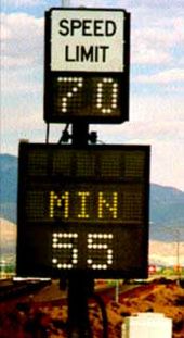
Applications include: Recently some jurisdictions have begun experimenting with variable speed limits that change with road congestion and other factors.
On the most heavily travelled 14-mile (23 km) section (junction 10 to 16) of the M25 variable speed limits combined with automated enforcement have been in force since 1995.
Initial results indicated savings in journey times, smoother-flowing traffic, and a fall in the number of accidents, so the implementation was made permanent in 1997.
The server processes a driving recommendation dedicated to a single or a specific group of drivers and transmits it wirelessly to vehicles.
Dedicated apps can be used to take mobile payments, provide data insights and navigation tools, offer incentives and discounts, and act as a digital commerce medium.
A flexible settlements and billing platform enables revenues to be shared quickly and easily and provides an overall better customer experience.
The ERTICO work programme focuses on initiatives to improve transport safety, security and network efficiency whilst taking into account measures to reduce environmental impact.