International Association of Geodesy
[1][2] In 1832, Carl Friedrich Gauss studied the Earth's magnetic field and proposed adding the second to the basic units of the metre and the kilogram in the form of the CGS system (centimetre, gram, second).
The coordination of the observation of geophysical phenomena such as the Earth's magnetic field, lightning and gravity in different points of the globe stimulated the creation of the first international scientific associations.
[5][6][7][8] As early as 1861, Johann Jacob Baeyer sent a memorandum to the King of Prussia recommending international collaboration in Central Europe with the aim of determining the shape and dimensions of the Earth.
This involved determining the geoid by means of gravimetric and leveling measurements, in order to deduce the exact knowledge of the terrestrial spheroid while taking into account local variations.
Baeyer developed a plan to coordinate geodetic surveys in the space between the parallels of Palermo and Freetown Christiana (Denmark) and the meridians of Bonn and Trunz (German name for Milejewo in Poland).
[28][29] In 1860, Elie Ritter, a mathematician from Geneva, using Schubert's data computed that the Earth ellipsoid could rather be a spheroid of revolution accordingly to Adrien-Marie Legendre's model.
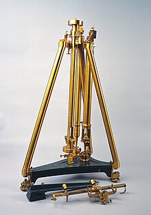
[34][35][36][37] This was later explained by clearance in the central axis of the repeating circle causing wear and consequently the zenith measurements contained significant systematic errors.
[38][19][39][18] Among all these sources of error, it was mainly an unfavourable vertical deflection that gave an inaccurate determination of Barcelona's latitude and a metre "too short" compared to a more general definition taken from the average of a large number of arcs.
[40][41][42] The creation of the International Geodetic Association would mark the adoption of new scientific methods which allowed to take into account observational errors in science.
[56] When Carlos Ibáñez e Ibáñez de Ibero first president of both the International Geodetic Association and the International Committee for Weigths and Measures took part to the remeasurement and extension of the arc measurement of Delambre and Méchain, mathematicians like Legendre and Gauss had developed new methods for processing data, including the "least squares method" which allowed to compare experimental data tainted with observational errors to a mathematical model.
The International Geodetic Association, which had covered Europe with a network of fundamental longitudes, took an interest in the question of an internationally-accepted prime meridian at its seventh general conference in Rome in 1883.
It seemed natural that it should contribute to the achievement of significant progress in navigation, cartography and geography, as well as in the service of major communications institutions, railways and telegraphs.
The conference concluded that Greenwich Observatory best corresponded to the geographical, nautical, astronomical and cartographic conditions that guided the choice of an international prime meridian, and recommended the governments should adopt it as the world standard.
[66] The International Geodetic Association gained global importance with the accession of Chile, Mexico and Japan in 1888; Argentina and United-States in 1889; and British Empire in 1898.
Among them, the most powerful and oldest was the International Geodesic Association where German influence predominated and which had its central office at the Prussian Geodetic Institute in Potsdam.
[67] At present there are 4 commissions and one inter-commission committee: The twelve IAG Services are split into three general topic areas: geodesy (IERS, IDS, IGS, ILRS, and IVS), gravity (IGFS, ICGEM, IDEMS, ISG, IGETS and BGI) and sea level (PSMSL).