Interstate 75 in Michigan
I-75 enters the state from Ohio in the south, north of Toledo, and runs generally northward through Detroit, Flint, and Bay City, crosses the Mackinac Bridge, and ends at the Canadian border in Sault Ste.
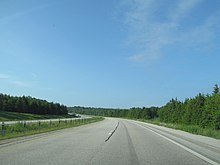
The landscapes traversed by I-75 include Southern Michigan farmland, northern forests, suburban bedroom communities, and the urban core of Detroit.
[8][9] On the north side of the county line, I-75 begins to run inland of, and parallel to, the Detroit River, entering the Downriver area.
The freeway turns back northeasterly in Taylor and intersects the southern end of M-39 (Southfield Highway) in Lincoln Park.
[11] Immediately east of Ford Field, I-75 turns northwesterly to follow the Chrysler Freeway away from the downtown Detroit area.
Continuing through Holly and Newark, the freeway transitions back to a rural, wooded setting and enters Genesee County.
From there, I-75/US 23 curves northwesterly to bypass Kawkawlin before continuing north to the Standish area through farmlands inland from the Saginaw Bay.
On the north side of Grayling, there is a full interchange for BL I-75/M-93 that provides the southbound I-75 connection to M-72 as well as access from both directions to Hartwick Pines State Park.
North of town, the freeway traverses the area between Burt and Mullett lakes before intersecting the southern end of M-27; that highway provides access to Topinabee and Cheboygan.
The freeway meets the northern end of US 31 and picks up the Lake Michigan Circle Tour (LMCT) designation before entering Emmet County on the south side of Mackinaw City.
[8][9] The structure, unlike the rest of the state highways in Michigan like I-75, is under the maintenance and control of the Mackinac Bridge Authority (MBA).
[a] The authority collects a toll from traffic that crosses the bridge,[16] which as of January 1, 2012[update], is $4 for passenger cars and $5 per axle for commercial vehicles and motorhomes.
[22] North of the Mackinac Bridge, I-75 passes to the west of downtown St. Ignace, traveling between the Father Marquette National Memorial and Straits State Park.
The freeway curves around Chain Lake and the Mackinac County Airport and meets the northern end of the business loop near Castle Rock; the LHCT returns to I-75 at that interchange as well.
Marie Municipal Airport and the campus of Lake Superior State University before meeting the customs and toll plazas for the International Bridge.
[30] In the 19th century, the Michigan Legislature chartered private companies to build and operate plank roads or turnpikes in the state, many of which replaced the original Indian trails.
[43] The Michigan Turnpike Authority (MTA), an agency which was created in 1951,[44] proposed the construction of a toll freeway to run north–south in the state.
[46] Ziegler, who had a seat on the MTA board, publicly sparred with authority chairman George Higgins, even announcing that the MSHD would build a parallel freeway that would "reduce tolls on the turnpike 40 to 50 percent" according to consultants.
[53] The proposed length was increased by December 1955; the extended Michigan Turnpike would have run from a connection across the Ohio state line to Toledo north through Detroit and Saginaw and eventually to the southern end of the Mackinac Bridge.
[57] By August 1956, the MTA voted to reduce its operations to a skeleton staff,[58] but moved forward in May 1957 on a bond sale to finance construction of the roadway.
[72] In 1961, the MSHD had proposed that the section of I-75 south of Detroit to Toledo be built as an electronic highway under a bid through General Motors;[73] the testing for such a roadway was ultimately done at Ohio State University instead.
[78] By the end of the year, the freeway was completed between Kinross and Dafter in the UP,[79] and the former segment of US 27 between Grayling and Gaylord was turned back to local control.
The northern section ran from the US 27-to-I-75 transition south of Grayling to the Crawford–Roscommon county line, and the second was an extension from Alger to the West Branch area.
[98][99] The first ice-detection system in the state was installed on the River Rouge bridges in the Detroit area in an attempt to maximize driver safety.
From the Cheboygan–Otsego county line north to the bridge, I-75 was named for G. Mennen Williams, the former governor once called "Michigan's Politician of the Century" in the press.
This early authority started with a 1921 proposal for a series of bridges that would have connected Cheboygan to St. Ignace by way of Bois Blanc, Round, and Mackinac islands.
[133] The structure was designed by David B. Steinman and built by Merritt-Chapman & Scott for the substructure and the American Bridge Company division of U.S. Steel Corporation for the superstructure.
With the two backstay spans, the Mackinac Bridge is 8,614 feet (2,626 m) long between cable anchorages, the longest in the world at the time it opened.
[85] The International Bridge is nearly three miles (4.8 km) long, encompassing spans over the American and Canadian navigation channels for the Soo Locks and the St. Marys River.
These business loops and spurs provide signed connections into the downtowns of Pontiac, Bay City, West Branch, Roscommon, Grayling, Gaylord, St. Ignace, and Sault Ste.