Israel National Trail
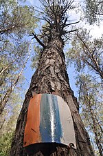
The trail is marked with three stripes (white, blue, and orange), and takes an average of 45–60 days to complete.
It is described as a trail that "delves into the grand scale of biblical landscapes as well as the everyday lives of the modern Israeli.
Winter is less popular due to rain, low temperatures and, in the southern sections of the trail, potential flash floods.
The Israel National Trail (INT) is the brainchild of Avraham Tamir, a journalist and hiker who hiked the Appalachian Trail in the late 70's and Ori Dvir, hiker, educator and one of the founders of The Society for Protection of Nature in Israel (SPNI).
The reasons for the change were the development of Highway 6, avoiding the security risk of walking along the Green Line and the desire to add to the trail sections with city and sea views.
This nickname refers to people who live along the trail and offer hikers assistance, such as providing accommodation with beds and a shower, allowing them to pitch a tent in their the yard or helping with transportation.
According to the magazine, "the joy of the trail is meeting the Israelis hiking it, and spending some time in small kibbutzim where local people take hikers into their homes.
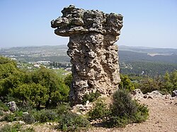
It passes by a rock formation known as Elijah's Chair, and the archaeological site of Khirbet Shema.
After following it for a while, the route departs from the Sea of Galilee, at Yardenit Baptismal Site, onto the Jordan River, which is follows very briefly.
The route passes by what were the villages of Awlam and Sirin, as well as the archaeological site of Tel Rekhesh.
After descending, the route again ascends, over Mount Devora, at the top of which is a monument to mark the silver wedding anniversary of Queen Elizabeth II and Prince Philip.
[10] The route passes through Kibbutz Yagur, to then enter, with a very steep ascent, Mount Carmel National Park.
It then descends at the prehistoric Etzba Cave, and passes by the artist's colony of Ein Hod.
Along the coast a very short way, the route goes by Caesarea Maritima, the vast ruins of an ancient Roman city.
Further south, the route goes by Latrun Monastery, an old Crusader castle, and the village of Neve Shalom.
Walking along Shayarot ridge, views are provided onto Highway 1, the main road from Tel Aviv to Jerusalem.
Shortly it passes by Bnei Brit Cave, a memorial dedicated to victims of the Holocaust.
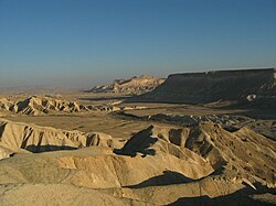
Heading south, it reaches an observation point on the rim of HaMakhtesh HaKatan, the first of the three Makhtesh the trail sees; it passes through and comes close to the gap (centre).
Later, the route passes through Mezad Tzafir, an ancient Roman stronghold that was a part of the Limes (frontier).
Next, the route climbs Mount Karbolet, the collapsed southern rim of HaMakhtesh HaGadol, (lit.
The route takes around two days to cross it, and comes close to Ein Saharonim, the deepest point of the Makhtesh.
In that story the mother of an Israeli soldier takes to the trail to occupy and distract herself while her son is engaged in a military operation.