List of historical states of Italy
Following the fall of the Western Roman Empire and the arrival of the Middle Ages (in particular from the 11th century), the Italian Peninsula was divided into numerous states.
The kingdoms of Sicily, Sardinia, Naples (inclusive of the State of Presidi) and the Duchy of Milan were left under the control of Spanish Habsburgs.
The Gonzaga in Mantua, the Este in Modena and Ferrara and the Farnese in Parma and Piacenza continued to be important dynasties.
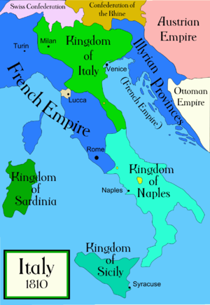
Their populations and other vital statistics stood as follows in the late 18th century:[7] Total: 18.3 million Following the defeat of Napoleon's France, the Congress of Vienna (1815) was convened to redraw the European continent.
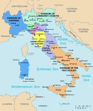
In Italy, the Congress restored the pre-Napoleonic patchwork of independent governments, either directly ruled or strongly influenced by the prevailing European powers, particularly Austria.