K-14 (Kansas highway)
[3][4] The sections of K-14 that overlaps US-54 and US-400 by Kingman, K-96 from South Hutchinson to Lyons, I-70 and US-40 north of Ellsworth, and US-36 east of Mankato is included in the National Highway System.
The highway travels north past an electrical substation then reaches an at-grade crossing with a BNSF Railway track.
The highway continues along the creek for 4.3 miles (6.9 km) and intersects SE 70 Street, where it crosses a Kansas and Oklahoma Railway track.
The highway advances north for another approximately 2.4 miles (3.9 km) and enters the city of Kingman as Main Street.
K-14 and K-96 continue north as a four-lane divided highway for 2.3 miles (3.7 km) and enters South Hutchinson where they intersect US-50 and K-61 via a diamond interchange.
K-14 and K-96 then cross over a Kansas and Oklahoma Railway track then curves northwest and reaches a diamond interchange with Wilson Road and Nickerson Boulevard.
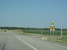
The roadway continues through flat rural farmlands for about 3.75 miles (6.04 km) and then enters the city of Nickerson as Railroad Street.
After about .35 miles (0.56 km) the highway turns southwest onto Nickerson Street and has an at-grade crossing with a Kansas and Oklahoma railway.
[18] The highway crosses the Arkansas River then passes through flat rural farmland for 3.65 miles (5.87 km) and intersects North Sego Road, which is the former routing of K-14 south.
The highway then intersects Cleveland Avenue, which accesses Sterling College, then exits the city .6 miles (0.97 km) later.
[14][22] As the highway enters the county it continues north through flat rural farmlands for roughly three miles (4.8 km) then becomes more hilly.
K-14 Truck follows K-156 east and K-14 continues north for about one mile (1.6 km) then curves northeast and crosses the Smoky Hill River as it enters the historic city of Ellsworth as Douglas Avenue.
It continues north for about four miles (6.4 km), crossing Oak Creek several more times, before reaching a diamond interchange with Interstate 70 (I-70) and US-40 at exit 219.
[14][24] The highway continues north into the county and begins to pass through the Smoky Hills Wind Farm and parallel West Elkhorn Creek.
The highway continues approximately 1.4 miles (2.3 km) and crosses the Saline River and a Kansas and Oklahoma Railway track.
K-14 proceeds north through rolling hills for about 2.4 miles (3.9 km) then intersects the western terminus of K-284, which travels east to Barnard.
K-14 continues north through rolling open hills for approximately four miles (6.4 km) then transitions back to flat farmlands.
K-14 continues for .25 miles (0.40 km), passes south of Mitchell County Community Hospital, then turns north at Independence Avenue.
[27] K-14 continues north through flat rural farmland for 5.6 miles (9.0 km) then curves west at and begins to follow the Mitchell–Jewell county line.
The highway continues through rolling hills for about 7.5 miles (12.1 km) before passing over White Rock Creek at the far western end of Lovewell Reservoir.
By Hutchinson the highway crosses the former New Santa Fe Trail, which ran from Kansas City to Los Angeles.
[31] The highway crosses K-4, which closely follows the former Bee Line, which began in Scott City and went east to Herington.
Further north in Lincoln, the highway intersects the former Blue Line, which began in Limon and went east to Junction City.
In Beloit, K-14 crosses the former Roosevelt National Highway, which ran from Washington, D.C. west to Los Angeles and San Francisco; the former Sunflower Trail; and the former Kansas White Way, which began in Colorado Springs and went east to St. Joseph.
[32][33] K-14 was first designated as a state highway in 1926, and began at K-44 in Anthony and ran north through Kingman, Ellsworth, Beloit, and Mankato to the Nebraska border.
[56][57] A work order was issued to the San-Ore Construction Company of McPherson in August 1961, to pave the bypass at a cost of $117,012.17 (equivalent to $193,807 in 2025).
In a December 14, 2012, resolution, it was approved to realign K-14 to travel east from Kingman then north along the former K-17 to K-96, which it followed northward and met its old alignment southwest of Hutchison.
The ambulance made it to the correct location, but the tow truck arrived on the old alignment of K-14, which is 14 miles (23 km) to the west.
[74][75] The project, part of a plan to build a diagonal corridor from Wichita northwest through Hutchinson and Great Bend to I-70 in Hays, was first considered by the state Legislature in 1986.
Construction of the Reno and Rice county segment was originally going to begin January 2017 and be complete by June 2018, but was cancelled then due to lack of funding.