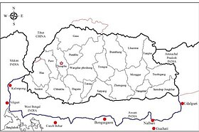
Kalimpong
[8] The Kalimpong Science Centre, established under the Darjeeling Gorkha Hill Council in 2008 is a recent addition to its many tourist attractions.
The Science Centre, which provides for scientific awareness among the students of the town and the locals sits atop the Deolo Hill.
[9] The name may be derived from the translation "ridge where we play" from Lepcha, as it was known to be the place for traditional tribal gatherings for summer sporting events.
Another possible derivation points to Kaulim, locally known as odal Scientific name Sterculia Villosa, a fibrous plant found in abundance in the region.
[16] The first recorded mention of the town was a fleeting reference made that year by Ashley Eden, a government official with the Bengal Civil Service.
[10] The temperate climate prompted the British to develop the town as an alternative hill station to Darjeeling, to escape the scorching summer heat in the plains.
The movement of people into the area, transformed Kalimpong from a small hamlet with a few houses, to a thriving town with increased economic prosperity.
Britain assigned a plot within Kalimpong to the influential Bhutanese Dorji family, through which trade and relations with Bhutan flowed.
[16] The young missionary (and aspiring writer and poet) Aeneas Francon Williams, aged 24, arrived in Kalimpong in 1910 to take up the post of assistant schoolmaster at Dr. Graham's Homes,[22] where he later became Bursar and remained working at the school for the next fourteen years.
In 1962, the permanent closure of the Jelep Pass after the Sino-Indian War disrupted trade between Tibet and India, and led to a slowdown in Kalimpong's economy.
Riots between the Gorkha National Liberation Front (GNLF) and the West Bengal government reached a stand-off after a forty-day strike.
The town was virtually under siege, and the state government called in the Indian army to maintain law and order.
Since 2007, the demand for a separate Gorkhaland state has been revived by the Gorkha Janmukti Morcha and its supporters in the Darjeeling hills.
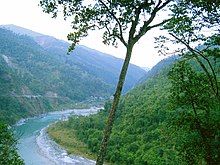
[26] The Shiwalik Hills, like most of the Himalayan foothills, have steep slopes and soft, loose topsoil, leading to frequent landslides in the monsoon season.
[33] The schools of Kalimpong, besides imparting education to the locals, attract a significant number of students from the plains, the neighbouring state of Sikkim and countries such as Bhutan, Bangladesh, Nepal and Thailand.
Kalimpong exports a wide range of traditional handicrafts, wood-carvings, embroidered items, bags and purses with tapestry work, copper ware, scrolls, Tibetan jewellery and artefacts.
[42] Regular bus services, Jeep Services and hired vehicles connect Kalimpong with Siliguri and the neighbouring towns and cities like Gangtok, Kurseong, Darjeeling, Namchi, Ravangla, Pakyong, Malbazar, Rhenock, Rongli, Algarah, Pedong, Labha, Gorubathan, Rangpo, Jaldhaka, Singtam, Pelling, Rorathang, Melli, Jorethang, Sevoke, Gyalshing and Mirik.
[48] Kalimpong elects eight councillors, who manage the departments of Public Health, Education, Public Works, Transport, Tourism, Market, Small scale industries, Agriculture, Agricultural waterways, Forest (except reserved forests), Water, Livestock, Vocational Training and Sports and Youth services.
[49] The district administration of Darjeeling, which is the authoritative body for the departments of election, panchayat, law and order, revenue, etc., also acts as an interface of communication between the Council and the State Government.
[citation needed] Indigenous ethnic groups include the Bhutia, Limbus, Rais, Sherpas, Magars,[62] Chettris, Bahuns, Thakuris, Gurungs, Tamangs, Yolmos, Bhujels, Yakkhas, Sunuwars, Sarkis, Damais and the Kamis.
[64] Kalimpong is the closest Indian town to Bhutan's western border, and has a small number of Bhutanese nationals residing here.
[62] Islam has a minuscule presence in this region, The Oldest settlers include people residing since the mid of 19th Century and also mostly Tibetan Muslims who fled in 1959 after Chinese invasion of Tibet.
[69] A popular snack in Kalimpong is the momo, steamed dumplings made of chicken, pork, beef or vegetable cooked in a wrapping of flour and served with watery soup.
[71] There are a large number of restaurants which offer a wide variety of cuisines, ranging from Indian to continental, to cater to the tourists.
[4][72] The cultural centres in Kalimpong include, the Lepcha Museum and the Zang Dhok Palri Phodang monastery.
Cable Television still provides service to many homes in the town and its outskirts, while DTH connections are now practically mandatory throughout the country.
These channels, which mainly broadcast locally relevant news, are produced by regional media houses and news networks, and are broadcast through the local cable network, which is now slowly becoming defunct due to the Indian government's ruling on mandatory digitisation of TV channels.
[83] The Red panda, Clouded leopard, Siberian weasel, Asiatic black bear,[84] barking deer,[85] Himalayan tahr, goral, gaur[85] and pangolin are some of the fauna found near Kalimpong.
Avifauna of the region include the pheasants, cuckoos, minivets, flycatchers, bulbuls, orioles, owls, partridges, sunbirds, warblers, swallows, swifts and woodpeckers.
The strains of cacti, though not indigenous to the locale, have been carefully cultivated over the years, and now the town boasts one of the most fascinating and exhaustive collections of the family Cactaceae.