Kallang
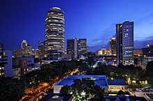
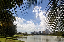
South East CDC Mountbatten SMC Tanjong Pagar GRC Kallang (IPA: /kɑːlɑːŋ/ is a planning area and residential zone located in the Central Region of Singapore.
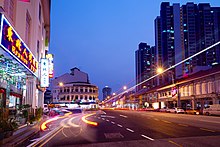
While the subzones of Little India and Kampong Glam constitute parts of Rochor,[13] many developments often associated with these two areas are located within Kallang, resulting in an "overspill" effect.
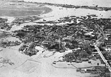
[20] The Kallang Basin area used to form part of mainland Singapore's southeastern coastline, as evident from the location of Beach Road.
Ulu is a Malay term which translates to "rural", "remote", "upstream" or "origin" – a reference to its location at the upper reaches of the Kallang River and its relative lack of development.
[27][28] The territories which once constituted Ulu Kallang are now shared among the planning areas of Central Water Catchment, Bukit Timah and Bishan, the first of which remained as one of the least developed places in Singapore.
[30] From 1963 to 1971, the Housing and Development Board (HDB) led a massive land reclamation project in the northern part of the Kallang Basin.
[31] Between 1966 and 1975, the East Coast Reclamation Project led by HDB formed new lands at Tanjong Rhu in southern Kallang, as well as the adjacent communities in Marine Parade.
One of the plans was to develop Kallang into Singapore's equivalent of the Hyde Park, as reported by The Straits Times in an article dated 11 March 1955.
On 4 December 1919, Singapore witnessed its first-ever aircraft landing at the Farrer Park Field, when Captain Ross Smith and three other crew members touched down in a Vickers Vimy en route to Darwin, Australia.
Captain Mohan Singh later declared the formation of the First Indian National Army and openly recruited volunteers to fight against the British Raj for the independence of India.
[37] On 29 June 1946, one of the Dakota aircraft belonging to the Royal Air Force (RAF) crashed at the Kallang Airport in a thunderstorm, killing all 20 that were on board.
[39] On 13 March 1954, a Lockheed L-749A Constellation aircraft operated by the British Overseas Airways Corporation (BOAC) crashed and exploded as it attempted landing at the Kallang Airport, killing 33 passengers and crew.
[41] On 18 March 1956, some 20,000 people gathered at the Kallang Airport complex for a merdeka (Malay for "freedom") rally organised by then-Chief Minister David Marshall.
[44] The old National Stadium that once stood on the same plot of land as the current Singapore Sports Hub was the ceremony venue for the Southeast Asian Games in 1973, 1983 and 1993.
From 1986 to 2000, former Singapore Prime Ministers Lee Kuan Yew and Goh Chok Tong held their annual National Day Rally at the Kallang Theatre.
[68] The main factory building of the former National Aerated Water Company along Serangoon Road has also been gazetted for conservation, and will be integrated into a future residential development.
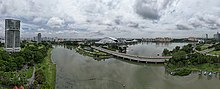
[80] Prior to modern developments, Kallang was home to a booming shipbuilding industry, particularly due to its coastal location and the presence of numerous waterways in the area.
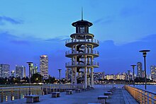
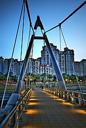
[96][97] Plans to further rejuvenate the Kallang riverside, including the construction of bridges and underpasses to facilitate seamless connection across major traffic junctions, have been proposed.
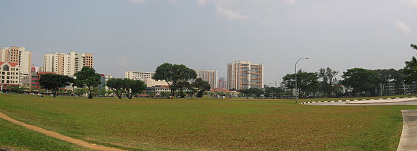
As a result of Kallang's prime location just outside the Central Area, the urban planning strategy and land use policy therefore differ from towns that are established primarily for residential use (e.g. Pasir Ris and Choa Chu Kang).
Housing precincts appear to be "discontinuous" and "scattered" in Kallang, as compared to the aforementioned towns with "clustered" and "concentrated" residential neighbourhoods.
In Kallang, lands set aside for residential developments may be punctuated with commercial, industrial or lifestyle areas, resulting in a disjointed town layout.
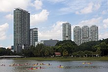
[110] Aside from public housing (flats) built by HDB, condominiums that provide high-end living options can be found primarily in Tanjong Rhu, an affluent neighbourhood in southern Kallang.
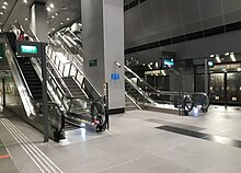
The following stations are currently in service:[127] A 16 kilometres-long "Kallang Line" was mentioned in the 1996 White Paper published by the Land Transport Authority (LTA).
[40] Opened on 12 June 1937 by Sir Shenton Thomas, the then-Governor of the Straits Settlements, Kallang Airport had the advantages of combined facilities for both land and marine aircraft.
[63] During its 18 years in service, the Kallang Airport played host to numerous high-profile celebrities such as Governor of Singapore Sir John Fearns Nicoll, former Premier of China Zhou Enlai, and renowned Chinese businessman and philanthropist Tan Kah Kee, among others.
[134] The decision to hold this art festival at the old Kallang Airport was controversial, with negative opinions surrounding the building's poor ventilation and inaccessibility.
[136] Predating the Kallang Airport, Singapore's first aircraft landing took place at the Farrer Park Field on 4 December 1919, when Captain Ross Smith touched down in a Vickers Vimy along with three other crew members.
Operated by the People's Association (PA) and located along Rhu Cross, PAssion WaVe @ Marina Bay offers water-themed activities.
The upcoming North–South Corridor (NSC) will enhance connectivity between Kallang, Toa Payoh, Bishan, Ang Mo Kio, Yishun and Woodlands.
The 2016 Mediacorp drama Hero is set primarily in the residential precinct of Dakota Crescent, within the Old Kallang Airport Estate.