Kish (Sumer)
Kish (Sumerian: Kiš; transliteration: Kiški; cuneiform: 𒆧𒆠;[1] Akkadian: Kiššatu,[2] near modern Tell al-Uhaymir) is an important archaeological site in Babil Governorate (Iraq), located 80 km (50 mi) south of Baghdad and 12 km (7.5 mi) east of the ancient city of Babylon.
The names of the next nine kings of Kish preceding Etana are Nanĝišlišma, En-tarah-ana, Babum, Puannum, Kalibum, Kalumum, Zuqaqip, Aba, Mašda, and Arwium.
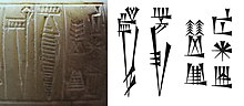
[11][12] Of the twenty-first king of Kish on the list, Enmebaragesi, who is said to have captured the weapons of Elam, is the first name confirmed by archaeological finds from his reign.
[4] He is also known through other literary references, in which he and his son Aga of Kish are portrayed as contemporary rivals of Dumuzid, the Fisherman, and Gilgamesh, early rulers of Uruk.
Because of the city's symbolic value, strong rulers later claimed the traditional title "King of Kish", even if they were from Akkad, Ur, Assyria, Isin, Larsa or Babylon.
The rulers of Babylon at its peak of power, Hammurabi and Samsu-iluna, are known to have done extensive construction at Kish, including rebuilding the city wall.
[10] After the Achaemenid period, Kish completely disappears from the historical record; however, archaeological evidence indicates that the town remained in existence for a long time thereafter.
During the Sasanian period, the site of the old city was completely abandoned in favor of a string of connected settlements spread out along both sides of the Shatt en-Nil canal.
This last incarnation of Kish prospered under Sasanian and then Islamic rule, before being finally abandoned during the later years of the Abbasid Caliphate (750–1258).
[29] After irregularly excavated tablets began appearing at the beginning of the twentieth century, François Thureau-Dangin identified the site as being Kish.
Austen Henry Layard and also Julius Oppert dug some trenches there in the early 1852 though the finds were lost in the Qurnah Disaster.
The name of the site as Kish was determined by George Smith in 1872 based on an inscribed brick of Adad-apla-iddina which had been discovered 60 years before.
[43][44] A bone awl from Phase 2 in the YWN area, the transition between Early Dynastic and Akkadian periods, was accelerator radiocarbon dated to 2471–2299 BC (3905 ± 27 C14 years BP).
The site was lightly occupied in the Akkadian period with modest towns on Ingharra and Mound W. During Ur III, Isin-Larsa, and Old Babylonian times there was a revival mostly centered around Uhaimir.
The later half of the 2nd millennium BC showed light occupation, all on Mound W. In the Neo-Babylonian period the rivercourse shifted from north to west, with Uhaimir having a large temple with associated fort, a major temple on Ingharra, and a major town on Mound W. The Achaemenid/Seleucid settlement was limited to the western end of Uhaimir.
[10] As part of this survey soundings were made at Umm-el-Jir (the site named Umm el-Jerab that Oriental Institute had found Old Akkadian tablets in 1932) 27 kilometers from Kish.
[46] More recently, a Japanese team from the Kokushikan University led by Hideo Fuji and Ken Matsumoto excavated at Tell Uhaimir in 1989–89, 2000, and 2001.
Located in the eastern side of the ancient Kish, Tell Ingharra was extensively explored during the Chicago excavation and provided the best known archaeological sequence in the 3rd millennium BC site.
[52][53] In particular, the 1923 excavation concentrated heavily on mound E with its twin ziggurats, while the roughly 130 meter square Neo-Babylonian temple, built on an Early Dynastic plano-copnvex platform, was one of the two buildings that was properly described in a published report.
Based on the findings from the larger ziggurat, it is suggested that the structures were built at the end of the Early Dynastic IIIa period to commemorate the city.
[52] The fascination of the ziggurats was interesting to the excavators as it was the only Early Dynastic structure that was not destroyed or obscured by later reconstructions, which was why it provided valuable evidence of that time period.
They also had identified the builder as Nabonidus or Nebuchadnezzar II based on the bricks with inscriptions and barrel cylinder fragments reported in the temple.
[55][56] But outstanding discoveries in Palace A rapidly overshadowed the contemporary excavation here, and the building remained partially uncovered.
[56] First recognized by Margueron, scholars have divided the building into four main sectors based on the architectural layout:[56] Mound A, which includes a cemetery and an Early Dynastic III palace, was discovered during 1922–1925 excavations conducted by Ernest Mackay, under the Field Museum and Oxford University.
[62] The archaeological findings within the palace lack pottery items, the most remarkable among them was a fragment of slate and limestone inlay work, which represents the scene of a king punishing a prisoner.
For personal reasons of the excavators, the Kish material in this section remained selective, mainly yielding Sasanian pottery, coins, incantation bowls and so on.
Researchers suspect that some of the buildings might function together as a complex serving different purposes, including royal residence, storage, and administration.
[37] The most prominent finding is the stucco decoration in the first two buildings, while the 1923–1933 team also figured out the floor plan and architectural structure of others.
Around Bahram V's palaces, a group of Sasanian people also took residence and developed a system of settlement and commercial activities.