Kreuzberg (Tempelhofer Berge)
It was named by King Frederick William III of Prussia after the Iron Cross which crowns the top of the Prussian National Monument for the Liberation Wars, designed by Karl Friedrich Schinkel, on its inauguration on 30 March 1821.
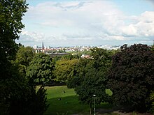
The Kreuzberg's relatively steep northern slope derives from the erosion by meltwater running into the Berlin-Warsaw glacial valley, when it was formed by the Weichselian glaciation.
[8] However, the prince-elector soon later sold the vineyards on the slope east of the houses on today's Heimstraße to private owners, mostly Cölln burghers, but kept those west of it including the Kreuzberg.
He employed vintners, called wine masters, each responsible for a vineyard of a certain size, giving the name Weinmeisterweg (Winemaster Way, today's Kreuzbergstraße at the northern foot of the Kreuzberg).
[11] In 1588 the financial chamber of the city of Cölln recorded for one of the vineyards an output of 13 and a half tons of red and white wine, amounting to 35 threescore and 45 groats.
[24] On top of the Kreuzberg, protected by the sconce on its southern slope, a redoubt was built comprising seven bomb-safe powder magazines, two huts for altogether 500 men, officially called the Citadel of Berlin.
[23] On 4 September 1818 King Frederick William III of Prussia approved the stipulated price of thalers 1,100 and an additional 400 as compensation for fixtures lost through the fortification works in 1813.
[24] For 19 September 1818 Duke Charles of Mecklenburg arranged the laying of the foundation stone for the war memorial projected for the top of the Kreuzberg and designed by Karl Friedrich Schinkel.
[29] For the inauguration of the Prussian National Monument for the Liberation Wars Frederick William III chose the 30 March 1821, the seventh anniversary of the conquest of the Montmartre in the Battle of Paris.
[31] The inauguration was attended by the royal family, the Prussian generality, the senior pastors of all Protestant congregations of Berlin, and as guests by Grand Duke Nicholas of Russia and his wife Alexandra Feodorovna (Charlotte of Prussia), as well as by thousands of other spectators.
[28] In the late 1820s the Geri(c)ke brothers bought the triangular site on the eastern slope of Kreuzberg, an exploited sand pit, between the former road to Teltow, the Halle highway and Colonnenweg (today's Dudenstraße) preparing a colony of villas there, later called Wilhelmshöhe.
[32] In 1829 the Gericke brothers further opened the amusement park named Tivoli, after the Parisian example, on the site of the levelled noise cannon sconce on the southern slope of the Kreuzberg, offering among others the so-called Russische Rutschbahn, a circular roller coaster running over hill and dale.
[45] Forty villas were planned, but only twenty were realised, since the area dropped in the favour of the better-off, when the urbanisation caused the adjacent quarters to be built up with blocks of flats.
[47] In 1879 Guido von Madai, president of the royal police, decreed a maximum height of buildings in the adjacent streets to uphold the visibility of the monument on the Kreuzberg.
The ordinance, however, was annulled by the groundbreaking 1882 "Kreuzberg judgement" of the Prussian Royal administrative court, stating that the police had exceeded its authority to ensure public security.
[48] On 14 December 1887 the city of Berlin acquired 8.5 ha (21 acres) of unbuilt slopes of the Kreuzberg from several owners, mostly north and west of the monument, including the westerly adjacent, lower hill called Rühlensberg.
[58] In September 1940 Zuse presented his experimental computer Z2, covering several rooms in the parental flat, to experts of the Deutsche Versuchsanstalt für Luftfahrt (DVL).
[59] The DVL granted research subsidies so that in 1941 Zuse rented a workshop on the opposite side in Methfesselstraße 7 and stretching through the block to Belle-Alliance Straße 29 (renamed and renumbered as Mehringdamm 84 in 1947).
[61][62] While Z3 was destroyed with the workshop in an Allied Air raid in 1943 and the parental flat in the following year, the successor Z4 was constructed in a new premise in Oranienstraße 6 and evacuated from Berlin on 14 February 1945, only arriving in Göttingen two weeks later.
The then planned axis consisting of a promenade and series of waterfalls cascading down the Kreuzberg hill towards the Platz der Luftbrücke was never realised, the interjacent block of houses remained untouched.
[64] In summer 1944 the Organisation Todt, also employing Soviet forced labourers else held captive at Blücherplatz, started driving five tunnels into the northern slope of the Kreuzberg from Kreuzbergstraße.
[67] It is the Memorial for the eastern German Homeland (Mahnmal für die ostdeutsche Heimat), an 8 m high (26 ft) cross of pine wood with a crown of thorns of barbed wire, located on the upper edge of the Kreuzberg's sodded northwestern slope, and commemorating the deaths of 100,000s killed in atrocities, by forced labour or other maltreatment, and the fate of the surviving 12 million refugees and expellees from former eastern Germany and neighbouring foreign countries ruled after World War II by pro-Soviet governments.
[68] The vineyard on Methfesselstraße provides for the local "Kreuz-Neroberger" wine, gained from vines donated by Kreuzberg's twin towns Wiesbaden (1968) and Ingelheim am Rhein (1975), as well by the Bergstraße county (1971 and 1973) and from Bad Bergzabern (1985).
[69] The brewery compound, with many excellent examples of industrial brick architecture, listed buildings, is since transformed into a new residential area called Viktoria-Quartier (Victoria Quarter).