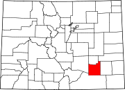
La Junta, Colorado
La Junta is located on the Arkansas River in southeastern Colorado 68 miles (109 km) east of Pueblo.
La Junta (Spanish for 'the junction')[9] was named for the fact it rested at the intersection of the Santa Fe Trail and a pioneer road to Pueblo.
During World War II, La Junta had an Army Air Force Training Base outside town.
[11] The area is high plains terrain, dry with short grass prairie and sagebrush, and is part of the Southwestern Tablelands ecological region.
[15] Bent's Old Fort National Historic Site, an important trading post along the Santa Fe Trail, is northeast of La Junta.
The Koshare Indian museum hosts a unique Boy Scout/Explorer program which trains the Scouts in both Native American dance and building traditional outfits.
[16] La Junta, until recently, had a railroad yard for assembling freight trains for the climb over Raton Pass.
The sole remaining major train crossing Raton Pass today is the daily Southwest Chief, in both directions, between Los Angeles and Chicago.
U.S. Highway 50 travels through La Junta, approaching from Pueblo to the northwest and continuing eastward towards Lamar and into Kansas.
[18] The former military airport, located 5 miles (8.0 km) north of La Junta, has 77 acres (31 ha) of tarmac and two runways.