Lake Qaraoun
[1][2] The annual surface water flow in the Litani River received at Lake Qaraoun is 420×10^6 m3 (15×10^9 cu ft).
During the dry season, 30×10^6 m3 (1.1×10^9 cu ft) of water is diverted from Markaba power station to meet the needs of the Kassmieh irrigation project.
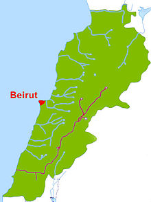
[3] The Litani River drains the southern end of the Beqaa Valley plains (a continuation of the Jordan Rift Valley), crossing the southern periphery of the Mount Lebanon range and discharging into the sea north of Tyre, after traversing a length of 170 km (110 mi) entirely in Lebanon.
[6] The climate in the catchment of the reservoir is of continental type with 90% of rainfall occurring between November and April, with January experiencing the maximum precipitation.
The average annual flow received at the reservoir is utilised through the dam created at the site and diverting it through a series of tunnels and ponds to generate 600 GWh of energy at three hydroelectric power stations (190 MW or 250,000 hp total installed capacity) located at Markaba, Awali and Jun.
[3] The Ibrahim Abdel Al hydroelectric power plant is located in Markaba in the Beqaa Governorate 11 km (6.8 mi) away from the lake and 660 m (2,170 ft) above sea level, it was established in 1962.
[8] The Charles Helou hydroelectric power plant became operational in 1968 and located in Joun on the bank of the Awali river 32 m (105 ft) above sea level.
The Qaraoun reservoir or lake created by Qaroun Dam on the Litani River has a water spread area of 11.9 km2 (5 sq mi).
Controlled reservoir operation also provides flood-control benefits and prevention of water logging in an area of about 1,500 ha (3,700 acres).
Untreated sewage from the towns of Baalbek, Houch el Rafqa, Qaa er Rim, Zahle, Chtoura, Qabb Elias, Bar Elias, Joub Jannine and Qaraoun flow into the Litani River or its tributaries, apart from industrial effluents many factories related to manufacture of sugar, paper, lead, limestone crushers, agro-industries and also from poultry farms, tanneries and slaughterhouses.
When the water level is at its lowest in the lake, a steppe-like land slope has been noticed with low vegetation of rocky shingle terrain where flocks of larks and lapwings are seen.
The ferruginous duck (Aythya nyroca), pallid harrier (Circus macrourus), greater spotted eagle (Aquila clanga), eastern imperial eagle (Aquila heliaca) and sociable lapwing (Vanellus gregarius) are some of the birds which are of conservation concern, according to the 2008 IUCN Red List.
[2] The Qaraoun Dam, built in the middle reaches of the Litani River, has created an artificial lake at (33°34′21″N 35°41′51″E / 33.57250°N 35.69750°E / 33.57250; 35.69750) with water-spread area of 1,190 ha (2,940 acres).
[10] The archaeological site of Ain Jaouze overlooks Lake Qaraoun at the foot of Jebel Baruk on the west of the road from Chtaura to Jezzine.
[11] Jesuit archaeologist, Auguste Bergy collected flints from the surface of this site, suggested to be similar to those of later neolithic Byblos.
In winter, when water level in the lake is high boats are operated to hunt for of birds such as wildfowl, mainly storks, heron, egrets and lark species.