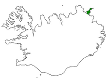
Langanes
It is bounded by Þistilfjörður to the northwest and Bakkaflói to the southeast, while the terrain inland reaches elevations of 200–450 metres (600–1200 feet).
Virtually all of the population live in the village of Þórshöfn (Thorshofn) on the northwestern coast, which has a small airport.
The fishing village of Skálar [ˈskauːlar̥], on the southeastern coast near the tip of the peninsula, had a population of over a hundred in the early 20th century, but was abandoned by 1946.
A radar station (NATO ID: H-2) was operated in Heiðarhöfn, on mountain Heiðarfjall [ˈheiːðarˌfjatl̥], from 1954 to 1968 to monitor Soviet activity in the GIUK gap.
The Langanes peninsula is popular with bird-watchers and holds the third largest gannet nesting place in the world at Stórkarl [ˈstourˌkʰa(r)tl̥].