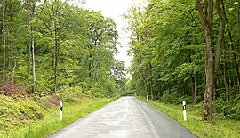
Lappwald
The Lappwald runs from north-west to south-east parallel to the Elm hills, which lie about 10 km further west.
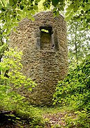
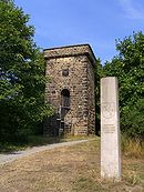
Another well-preserved medieval watchtower is located immediately next to the B 1 federal road to Magdeburg on the edge of the Lappwald.
From a geological point of view, the Lappwald, which reaches a height of 211 m on the Heidberg, is a hollow, that only appears like a raised horst due to the sharply downfaulted terrain it is surrounded by.
In the Cretaceous, a period of some 71 million years, the sea washed chalk, marls and sands in several flood phases into the Helmstedt and Schöppenstedt hollow and thus covered the underlying rock.
Further flooding by the sea in the succeeding Tertiary era created large areas of bog in the Helmstedt Basin that were transformed under sub-tropical climatic conditions into massive brown coal deposits.