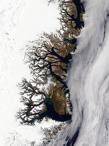
Lindeman Fjord
The outer part of the fjord was first surveyed by Carl Koldewey during the 1869–70 Second German North Polar Expedition.
Koldewey named it Lindeman Bai after Moritz Karl Adolf Lindeman (1823 – 1908), secretary of the Association for German Polar Exploration (Verein für die Deutsche Nordpolarfahrt) in Bremen.
[1] Later, during the 1929–1930 Expedition to East Greenland led by Lauge Koch, more thorough surveys were made and the fjord was found to become narrow to the west and extend further inland, thus the water body was renamed "Lindeman Fjord".
[3] A massive mountain named Hohe Kugel rises north of the mouth of the fjord.
Svejstrup Dal, a long valley at the head of Lindemann Fjord, stretches northwestwards between A. P. Olsen Land and Thomas Thomsen Land[1] This Greenland location article is a stub.