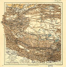
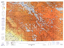
List of locations in Aksai Chin
This is a list of basins, camping grounds, lakes, mountains, mountain passes, outposts, plains, rivers, ruins, settlements, streams, valleys, villages, and other geographical features located in (or partially included in) the sparsely populated Aksai Chin region administered by China.
The alternate language names of locations in the Aksai Chin area are included for reference.
On some maps, the road intersections in the region are also referred to with the simple named "(blank)岔口" where "(blank)" is the Chinese initial of the destination, and 岔口 simply means "road fork".
For example, 天岔口, 河岔口, and 空岔口 for the road forks to Tianwendian, Heweinan, and Kongka Pass respectively.
Including camping grounds on historical caravan routes in Aksai Chin: These are simply referred to as halting place which are places with sufficient vegetation, water, or natural shelter to warrant stopping or camping for historical caravans that depended upon beasts of burden.