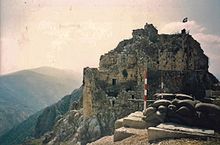
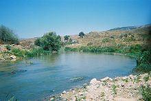
Litani River
The river rises in the fertile Beqaa Valley, west of Baalbek, and empties into the Mediterranean Sea north of Tyre.
[5] Historians in the past have suggested that the location of Biblical Misrephoth Maim, the place to which Joshua chased the various tribes after their defeat at the waters of Merom, was the river-mouth of the Litani River.
The basin spans 263 villages in 12 districts and 4 governorates, covering a significant portion of Lebanon's ecological landscape and contributing around 30% of the total water flow in the country.
For the entire stretch of the Qasimiyeh as it flows into the Mediterranean Sea, the Litani River remains nearly parallel to (and about 29 km (18 mi) north of) the Israeli-Lebanese border.
[9] A spillway of 6503 meters carries the water to the underground station where generators produce a maximum of 185 megawatts of electricity, the largest hydroelectric project in Lebanon.
Shortly after its formation, the authority engaged in a massive hydroelectric development project[10] that tapped the 850 meter head potential between Lake Qaraoun and the Mediterranean.
The advent of a protracted civil strife in the 1970s followed by a prolonged occupation in the 1980s that lasted into the 1990s, plunged Lebanon into disarray, freezing development and investment in infrastructure.
The return to normal conditions has encouraged the river authority to initiate several major water diversion projects from the Upper Litani Basin worth hundreds of millions of US dollars.
The root causes include uncontrolled sewage disposal and the indiscriminate use of fertilizers in agriculture, threatening both water quality and the health of the river.