Little Sur River
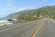
The river and its main tributary, the a 11.1-mile (17.9 km)[1]: 166 long South Fork, drain a watershed of about 40 square miles (100 km2) of the Big Sur area, a thinly settled region of the Central California coast where the Santa Lucia Mountains rise abruptly from the Pacific Ocean.
The river's steep canyons and high chaparral-covered ridges are host to a number of rare species including the Santa Lucia Fir, Dudley's lousewort, and virgin stands of old-growth redwood.
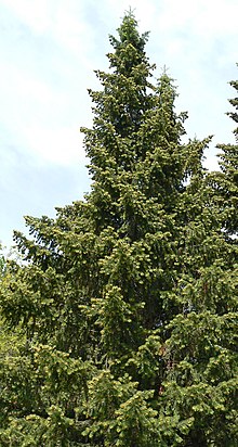
[8] The watershed is populated with coastal redwood, Douglas fir, western sycamore, bay laurel, bigleaf maple, and tanbark oak.
Near Camp Pico Blanco, the river meets the Palo Colorado fault and follows it northwesterly for about 1 mile (1.6 km), before turning west towards the Pacific Ocean.
[3]: 355 The north and south forks of the Little Sur River straddle either side of Mount Pico Blanco, Spanish for "White Peak."
[11] The Little Sur River basin climate, protected for the most part from coastal fog by Pico Blanco, is characterized by hot, dry summers and rainy, mild winters.
The South Fork is unrestricted by any man-made dams, but an impassable waterfall about 12 feet (3.7 m) high 11 miles (18 km) upstream prevents steelhead from migrating further.
[16] There is a seasonal 11 feet (3.4 m) high concrete flash board dam on the North Fork of the river in the Camp Pico Blanco.
After intervention by Rep. Sam Farr and Senator Bruce McPherson, the Fish and Game retreated from preventing the council from filling the dam, but stipulated that certain regulations must be adhered to.
[21] In 2002, Fish and Game staff surveyed the Little Sur River in the vicinity of the Camp Pico Blanco and found "numerous" steelhead fry and fingerlings.
[3] The North Fork of the Little Sur River supports the largest known population found on public lands of the rare Dudley's lousewort.
The area was first occupied by the Esselen American Indians who followed local food sources seasonally, living near the coast in winter, where they harvested rich stocks of mussels, abalone and other sea life.
[34] On June 14, 1771, Father Junípero Serra founded Mission San Antonio de Padua near the current town of Jolon.
By about 1822, much of the native Indian population had been forced into the Spanish mission system, and most of the interior villages within the current Los Padres National Forest were uninhabited.
[35] Virtually all of the Esselen were baptized and relocated to Mission San Carlos Borromeo de Carmelo in present-day Carmel, California, where many died from disease, demoralization, poor food, and overwork.
The last baptism of an Esselen native was recorded in 1808, and there is evidence that some members may have avoided control of the Spanish mission by escaping into the relatively inaccessible upper reaches of the Carmel and Arroyo Seco Rivers' watershed.
On July 30, 1834, Mexican governor José Figueroa conveyed the 8,949-acre (36 km2) Rancho El Sur land grant to Juan Bautista Alvarado.
After California revolted against Mexican rule and became a U.S. state, a few hardy pioneer homesteaders settled in the Big Sur region, drawn by the promise of free 160 acre (0.6 km2) parcels.
The bark was used to manufacture tannic acid, necessary to the growing leather tanning industry located in Santa Cruz, about 80 miles (130 km) to the north.
At the coast, the tanbark was loaded by cable onto waiting vessels anchored offshore at a dog-hole port named Notley's Landing.
)[13] Other early homesteaders in the Palo Colorado Canyon region included Thomas W. Allen, 1891, Isaac N. Swetnam, 1894, Harry E. Morton, 1896, Samuel L. Trotter, 1901, Abijah C. Robbins, 1901, and Antare P. Lachance, 1904.
[43] Swetnam bought the Notley home at the mouth of Palo Colorado Canyon and also constructed a small cabin on the Little Sur River at the site of the future Pico Blanco camp.
"[46][47] A travel brochure published in 1890 describes the "embryo Saratoga Springs ... owned by Mr. Keleher, who discovered them, and Dr. S. M. Archer" of Monterey County Hospital.
It states that the springs "are situated nearly fifty feet above the river channel" and reported that, "The ocean, with a beautiful sandy beach, is but two miles distant.
He guaranteed guests their full limit of trout from the Little Sur River, bragging that children could catch fish with bent pin hooks.
[55] When Alfred died in an auto accident on September 2, 1913, his two siblings Abelardo and Alice assigned their interest in his estate including the Rancho to their mother, Martha.
[21] In a series of competing ads beginning on May 2, 1914, Martha Cooper placed a notice in the Monterey Daily Express that the "summer resort on the Little Sur River known as 'Idlewild' is permanently closed to the public."
In October, 1905 the land that now makes up the Los Padres National Forest, including the South Fork and portions of the upper reaches of the North Fork of the Little Sur River watershed, were withdrawn from public settlement by the United States Land Office,[27] although current landholders were allowed to retain their property.
In January 1908, 39 sections of land, totaling 25,000 acres (10,000 ha), were added to the Monterey National Forest by President Theodore Roosevelt in a presidential proclamation.
Interest in preserving the abundant growth of redwoods in the area prompted newspaper publisher William Randolph Hearst to purchase the entire acreage.